File:Mount Vernon Trail Site Map, Project Years 2004-2012 - DPLA - 314c51769fc951672f0db7009d7193f4.pdf
Jump to navigation
Jump to search

Size of this JPG preview of this PDF file: 340 × 599 pixels. Other resolutions: 136 × 240 pixels | 272 × 480 pixels | 436 × 768 pixels | 1,235 × 2,175 pixels.
Original file (1,235 × 2,175 pixels, file size: 145 KB, MIME type: application/pdf)
Captions
Captions
Add a one-line explanation of what this file represents
Summary[edit]
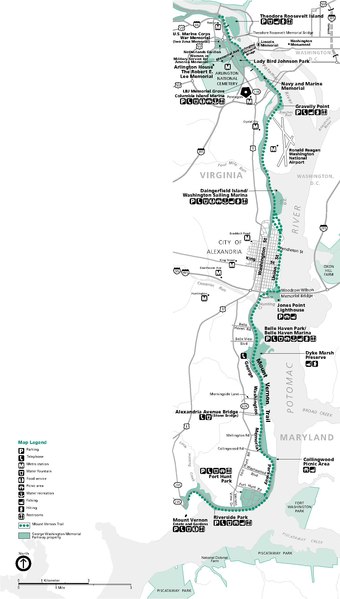
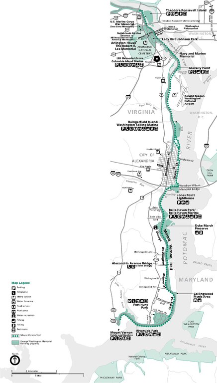
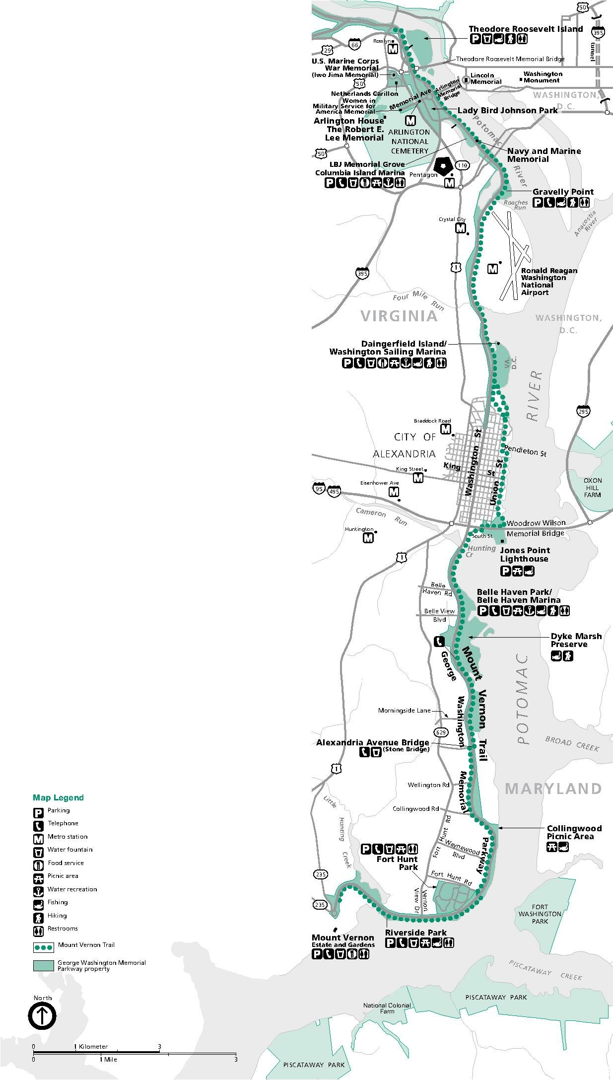
| Mount Vernon Trail Site Map, Project Years 2004-2012
( |
||||||||||||||
|---|---|---|---|---|---|---|---|---|---|---|---|---|---|---|
| Creator | Department of the Interior. National Park Service. Harpers Ferry Center. (11/1/1969) | |||||||||||||
| Title |
Mount Vernon Trail Site Map, Project Years 2004-2012 |
|||||||||||||
| Collection |
|
|||||||||||||
| Source/Photographer |
|
|||||||||||||
| Permission (Reusing this file) |
|
|||||||||||||
| Standardized rights statement |
|
|||||||||||||


File history
Click on a date/time to view the file as it appeared at that time.
| Date/Time | Thumbnail | Dimensions | User | Comment | |
|---|---|---|---|---|---|
| current | 21:48, 12 July 2021 |  | 1,235 × 2,175 (145 KB) | DPLA bot (talk | contribs) | Uploading DPLA ID 314c51769fc951672f0db7009d7193f4 |
You cannot overwrite this file.
File usage on Commons
The following page uses this file: