File:AA bedrock bedmap2.4960.tif
Jump to navigation
Jump to search

Size of this JPG preview of this TIF file: 800 × 450 pixels. Other resolutions: 320 × 180 pixels | 640 × 360 pixels | 1,024 × 576 pixels | 1,280 × 720 pixels | 1,920 × 1,080 pixels.
Original file (1,920 × 1,080 pixels, file size: 3.66 MB, MIME type: image/tiff)
Captions
Captions
Add a one-line explanation of what this file represents
Summary
[edit]| Description |
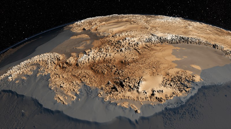
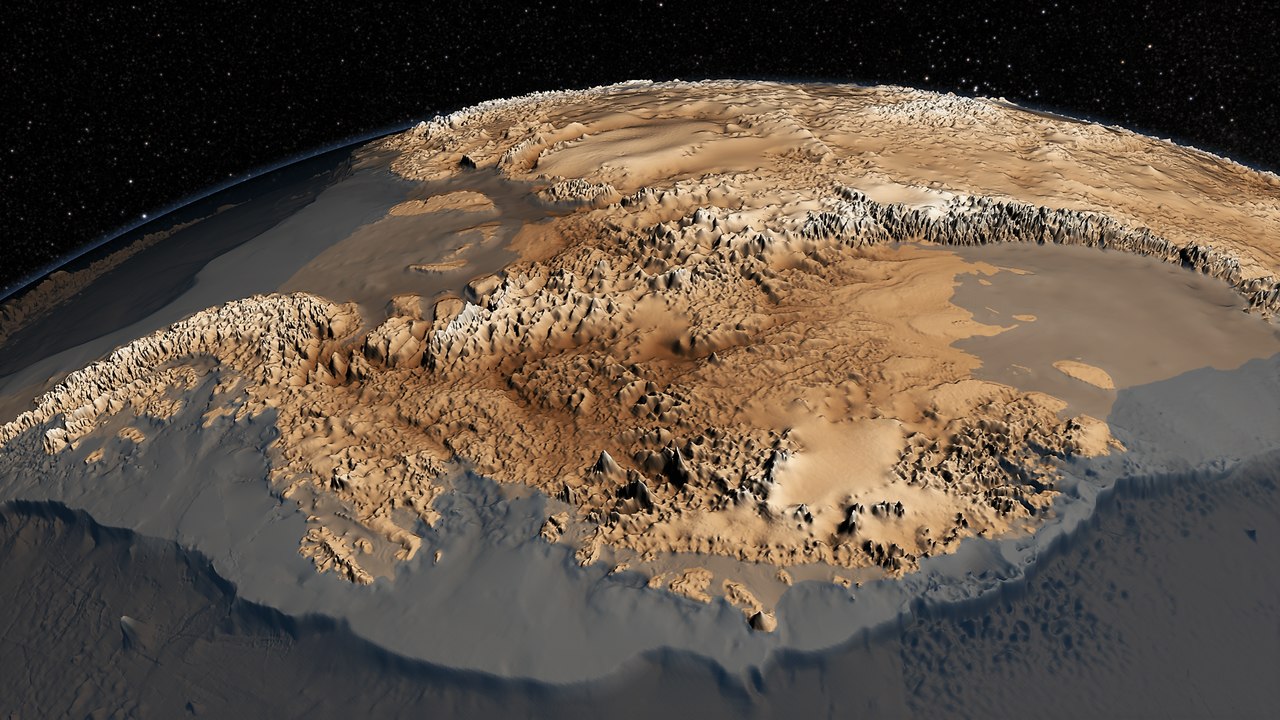
English: The topography of the bedrock under the Antarctic ice sheet is critical to understanding the dynamic motion of the ice sheet, its thickness and its influence on the surrounding ocean and global climate. In 2001, the British Antarctic Survey (BAS) released a map of the bed under the Antarctic Ice Sheet and the seabed extending out on to the continental shelf derived from data collected by an international consortium of scientists over the prior fifty years. The resulting dataset was called BEDMAP (or BEDMAP1).
In 2013, BAS released an update of the topographic dataset called BEDMAP2 that incorporates twenty-five million measurements taken over the past two decades from the ground, air and space. This animation compares the new BEDMAP2 dataset to the original BEDMAP1 dataset Source http://svs.gsfc.nasa.gov/cgi-bin/details.cgi?aid=4060 |
| Date | |
| Source | http://www.nasa.gov/topics/earth/features/antarctic-map.html |
| Author | NASA Goddard's Scientific Visualization Studio |
Licensing
[edit]| This file is in the public domain in the United States because it was solely created by NASA. NASA copyright policy states that "NASA material is not protected by copyright unless noted". (See Template:PD-USGov, NASA copyright policy page or JPL Image Use Policy.) | ||
 |
Warnings:
|
File history
Click on a date/time to view the file as it appeared at that time.
| Date/Time | Thumbnail | Dimensions | User | Comment | |
|---|---|---|---|---|---|
| current | 15:34, 15 January 2022 |  | 1,920 × 1,080 (3.66 MB) | Amitchell125 (talk | contribs) | lightened and brightened |
| 15:59, 1 August 2014 |  | 1,920 × 1,080 (2.64 MB) | Prokaryotes (talk | contribs) | User created page with UploadWizard |
You cannot overwrite this file.
File usage on Commons
The following 3 pages use this file:
File usage on other wikis
The following other wikis use this file:
- Usage on ar.wikipedia.org
- Usage on de.wikipedia.org
- Usage on el.wikipedia.org
- Usage on en.wikipedia.org
- Usage on es.wikipedia.org
- Usage on fa.wikipedia.org
- Usage on fi.wikipedia.org
- Usage on hi.wikipedia.org
- Usage on it.wikipedia.org
- Usage on kn.wikipedia.org
- Usage on ko.wikipedia.org
- Usage on mk.wikipedia.org
- Usage on pl.wikipedia.org
- Usage on ru.wikipedia.org
- Usage on sl.wikipedia.org
- Usage on tr.wikipedia.org
- Usage on vi.wikipedia.org
- Usage on zh.wikipedia.org