Category:Satirical maps
Jump to navigation
Jump to search
Subcategories
This category has the following 6 subcategories, out of 6 total.
Media in category "Satirical maps"
The following 22 files are in this category, out of 22 total.
-
 "רכבת שדים עדתיים".png 274 × 184; 14 KB
-
-
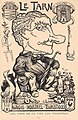 Charles Liozu Le Tarn.jpg 675 × 1,040; 547 KB
-
 Deutschland aus Berliner Sicht.svg 596 × 842; 445 KB
-
 Europa geografico-politica mappa satirica 1871 circa.jpg 4,339 × 3,149; 2.46 MB
-
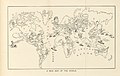
 Europa Volgens de nieuwste Verdeeling.jpg 4,292 × 5,870; 7.07 MB
-

-
 Geography Bewitched - Scotland.jpg 4,117 × 5,214; 7.38 MB
-

-

-
 Hall Another World and Yet the Same 1607 Cornell CUL PJM 1009 01.jpg 6,371 × 6,026; 4.83 MB
-
 Humoristische Karte von Europa im Jahre 1870.jpg 1,965 × 1,495; 1.25 MB
-
 Life Magazine February 10 1916.jpg 1,724 × 2,080; 1.71 MB
-
 Map from Mundus alter et idem.jpg 250 × 216; 22 KB
-
 Map of Iran in Mollanasreddin magazine.jpg 2,048 × 1,354; 563 KB
-
 O caput elleboro dignum (Monde dans une tête de fou) - btv1b7710391q.jpg 5,064 × 4,096; 2.79 MB
-
 Satirical map of Miami University campus n.d. (3192347112).jpg 1,498 × 1,195; 290 KB
-
 Sylt Autoaufkleber.jpg 478 × 466; 53 KB
-
 Texas - A Texas """"Howdy."""" (NBY 434377).jpg 810 × 513; 132 KB
-
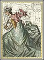
 The figure of a woman representing the map of Scotland. Etch Wellcome V0040811.jpg 2,409 × 2,939; 3.84 MB
-
 U.S. Classified Documents per 1000 People.jpg 2,326 × 1,306; 307 KB
-
 Wilsons Fourteen Points -- European Baby Show.png 537 × 595; 575 KB

.jpg)


.jpg)
.jpg)


_-_btv1b7710391q.jpg)
.jpg)

.jpg)


