Category:SVG labeled maps of administrative divisions of Bahrain (location map scheme)
Jump to navigation
Jump to search


.svg)


_(Paris_zoom).svg)
.svg)
,_administrative_divisions_-_de_-_colored_(multizoom).svg)
_-_colored.svg)
.svg)
,_administrative_divisions_-_Nmbrs_(multizoom).svg)
,_administrative_divisions_-_de_-_colored.svg)
_-_de_-_colored.svg)

.svg)

.svg)
Media in category "SVG labeled maps of administrative divisions of Bahrain (location map scheme)"
The following 10 files are in this category, out of 10 total.
-
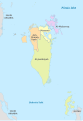
 Bahrain, administrative divisions - de - colored.svg 1,246 × 1,607; 452 KB
-
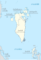
 Bahrain, administrative divisions - de - monochrome.svg 1,246 × 1,607; 453 KB
-
 Bahrain, administrative divisions - et - colored.svg 1,246 × 1,808; 552 KB
-
 Bahrain, administrative divisions - Nmbrs - colored.svg 1,246 × 1,607; 452 KB
-
 Bahrain, administrative divisions - Nmbrs - monochrome.svg 1,246 × 1,607; 453 KB
-
 Bahrain, administrative divisions - th - colored.svg 1,246 × 1,808; 682 KB
-
 Bahrain, administrative divisions - th - monochrome.svg 1,246 × 1,808; 572 KB
-
 Bahrain, administrative divisions - th-en - colored.svg 1,246 × 1,808; 623 KB
-
 Bahrain, administrative divisions - th-en - monochrome.svg 1,246 × 1,808; 630 KB
-
 Bahrain, administrative divisions 2014 - de - colored.svg 1,246 × 1,808; 542 KB


