Category:Oudezijds Achterburgwal 219, Amsterdam
Jump to navigation
Jump to search
| Object location | | View all coordinates using: OpenStreetMap |
|---|
building in Amsterdam, Netherlands  | |||||
| Upload media | |||||
| Instance of | |||||
|---|---|---|---|---|---|
| Location | Amsterdam, North Holland, Netherlands | ||||
| Street address |
| ||||
| Located on street | |||||
| Heritage designation |
| ||||
 | |||||
|
This is a category about rijksmonument number 71
|
| Address |
|
Media in category "Oudezijds Achterburgwal 219, Amsterdam"
The following 4 files are in this category, out of 4 total.
-
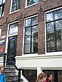
 Amsterdam - Oudezijds Achterburgwal 219.jpg 1,936 × 2,592; 2.9 MB
-
 Oudezijds Achterburgwal 219 door.JPG 1,728 × 2,304; 1.1 MB
-
 Oudezijds Achterburgwal 219 top.JPG 1,728 × 2,304; 1.2 MB
-
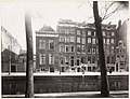 Stadsarchief Amsterdam, Afb 012000005573.jpg 2,752 × 2,103; 889 KB


