Category:Oceanographical maps
Jump to navigation
Jump to search
Italiano: carte oceanografiche
· - please tag SVG-maps also Category:SVG geology
See also:
- Category:Physical geography - some of its subcategories have many maps.
- Category:Maps of oceans - some of its subcategories have many maps.
- Category:Ocean topography and Category:Bathymetry - for maps about subarine relief
Subcategories
This category has the following 13 subcategories, out of 13 total.
Media in category "Oceanographical maps"
The following 121 files are in this category, out of 121 total.
-
 1991 Heard Island Feasibility Test.png 2,538 × 1,202; 1.66 MB
-
 2008-04-countries.png 1,006 × 576; 117 KB
-
 2013090417 5 flag.png 658 × 930; 193 KB
-
 2014-03-countries.png 1,755 × 1,005; 149 KB
-
 2016-04-countries.png 3,509 × 2,481; 737 KB
-
 2018-02-countries-bgc.png 3,509 × 2,481; 184 KB
-
 2018-02-deep.png 3,509 × 2,481; 235 KB
-
 2018-2022 Voyage of the PD+LF v3.jpg 2,124 × 1,306; 567 KB
-

-

-
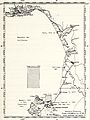
 Admiralty Chart No 5283 Svalbard to Nordkapp Oceanographic Chart, Published 1964.jpg 12,359 × 8,472; 21.45 MB
-

-
-

-

-

-

-

-

-
 Analysis of observed and modeled mixed layers- NOCAL region. (1983) (18142862046).jpg 2,194 × 2,518; 792 KB
-

-
 Anomalía TSM Mayo 2015 Pacífico sur.jpg 700 × 448; 138 KB
-
-
 Argo floats in Feb. 2018 colour coded by country.png 3,509 × 2,481; 377 KB
-
 ATL-LLWBCs-labelled.jpg 2,212 × 2,226; 290 KB
-
 Baltic Sea circulation.svg 1,966 × 1,083; 1.34 MB
-
 Bathymetry Lototenvortex.png 14,839 × 7,564; 14.99 MB
-
 Bengal-study area hg.png 980 × 638; 436 KB
-
 Bibliography of marine geology and oceanography, California coast (1955) (19745517014).jpg 3,604 × 3,662; 3.63 MB
-
 Bibliography of marine geology and oceanography, California coast (1955) (19745525954).jpg 3,398 × 2,660; 2.27 MB
-
 Bibliography of marine geology and oceanography, California coast (1955) (19745536944).jpg 3,424 × 2,320; 2.33 MB
-
 Bibliography of marine geology and oceanography, California coast (1955) (19747277273).jpg 2,892 × 3,284; 3.16 MB
-

-
 Bibliography of marine geology and oceanography, California coast (1955) (20341964956).jpg 2,982 × 3,154; 3.11 MB
-

-
 Bibliography of marine geology and oceanography, California coast (1955) (20359704272).jpg 4,630 × 1,998; 2.47 MB
-
 Bibliography of marine geology and oceanography, California coast (1955) (20368212335).jpg 2,922 × 2,970; 2.93 MB
-
 Bibliography of marine geology and oceanography, California coast (1955) (20374316821).jpg 2,428 × 2,988; 2.52 MB
-
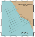
 CalCOFI Survey Station Grid since 1984.jpg 1,205 × 1,266; 368 KB
-
 CalCOFIStationMap.png 500 × 525; 59 KB
-
 Calypso51-73.jpg 677 × 409; 222 KB
-
 Carte des partenaires du projet DYMAPHY.jpg 3,461 × 2,915; 489 KB
-
 CarteBE-IFREMER-27avr13-WKA.jpg 679 × 376; 322 KB
-
 CarteSailwx-12-07-18-LaLouise-WKA.jpg 1,600 × 963; 233 KB
-
 CIESM Member States.jpg 2,402 × 1,456; 2.97 MB
-
 Cook Sampling.png 2,219 × 2,252; 2.4 MB
-
 Corriente de Benguela-png.png 1,366 × 625; 1.45 MB
-
 Current meter inventory.jpg 555 × 507; 84 KB
-
 Dai,2016 fig2.9.png 787 × 497; 430 KB
-
 DeltaSA final.jpg 612 × 408; 70 KB
-
 Detailed thermal structure of the western gulf stream region (1968) (20874602872).jpg 2,688 × 1,372; 842 KB
-
 Diagram of California Current System.png 864 × 1,067; 200 KB
-
 Die physische Geographie des Meeres (1856) (20914823686).jpg 3,566 × 2,106; 1.39 MB
-
 Durand,2019 fig4.png 743 × 471; 138 KB
-

-
 EMP mean1987 2014.png 5,319 × 2,510; 1.51 MB
-
 Evaporation globalmean1987 2014.png 5,201 × 2,559; 1.58 MB
-
 Evolution of vorticity in Andaman sea.gif 582 × 861; 9.65 MB
-
 Expl0058 (28006183060).jpg 3,021 × 1,693; 465 KB
-
 Expl0084 (27671691474).jpg 3,064 × 1,867; 350 KB
-
 Expn0899 (28287733275).jpg 1,920 × 1,080; 1.81 MB
-
 Expn0900 (28287733665).jpg 1,920 × 1,080; 890 KB
-
 Expn0913 (28287732825).jpg 1,920 × 1,080; 1.32 MB
-
 Expn4943 (27671691964).jpg 1,920 × 1,080; 768 KB
-
 Expn5951 (27671691664).jpg 1,920 × 1,080; 952 KB
-
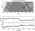
 Float trajectories.JPG 949 × 528; 75 KB
-
 Float travel 2.jpg 850 × 750; 69 KB
-
 Float Travel.jpg 473 × 466; 37 KB
-
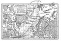
 FMIB 36341 Forbes's Distributional Map of British Seas.jpeg 599 × 745; 125 KB
-
 FMIB 36700 Fragment d'une Carte des Vents, a l'usage des navigateurs.jpeg 1,227 × 947; 205 KB
-
 FMIB 36712 Courant Polaire Arctique.jpeg 1,498 × 891; 368 KB
-
 FMIB 36723 Planisphere des Vents Oceaniques du Mois de Juillet.jpeg 1,227 × 912; 399 KB
-

-
 FMIB 36812 Profil Schematique d'Une Barre de Maree.jpeg 684 × 323; 45 KB
-
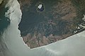
 Foggy Peruvian Valleys.jpg 2,899 × 3,306; 10.05 MB
-
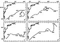 Four float trajectories.JPG 956 × 667; 82 KB
-
 Global Map of Oceanic Plate Age by Fabio Crameri.png 2,953 × 1,967; 4.45 MB
-
 Globaldrifter.gif 1,188 × 696; 397 KB
-
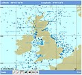
 Greenland OpenSeaMap.jpg 771 × 965; 128 KB
-
 Habenicht-Treibeisschwankungen im Nordatlantischen Ozean.jpg 3,516 × 2,382; 5.01 MB
-
 Ind-LLWBCs-labelled.jpg 2,188 × 2,224; 356 KB
-
 ISS016-E-16812 - View of Nicaragua.jpg 3,032 × 2,008; 1.03 MB
-
 Kuroshio geschwindigkeit.png 792 × 464; 201 KB
-
 Kuroshio SST.png 792 × 464; 99 KB
-
 Latent Heat Flux.png 1,886 × 928; 3.94 MB
-
 Latitudinal Compression of Surface Temperatures - NARA - 7384901.jpg 3,346 × 3,229; 2.31 MB
-
 Locations Mediterranean Outflow.jpg 14,600 × 14,147; 5.98 MB
-
 M2.3 Bathypelagic ocean waters.png 1,440 × 694; 45 KB
-
 Marine regions of the world.jpg 1,153 × 842; 168 KB
-
 Methodephysat.png 2,456 × 1,017; 1.29 MB
-
 Mixed layer depth seasonal cycle.png 2,721 × 1,504; 1.91 MB
-
 Mixed layer depth.png 930 × 1,185; 2.86 MB
-
 Mode water chao sun1.tif 1,678 × 1,204; 2.43 MB
-
 MygifCurrent.gif 1,352 × 664; 23.51 MB
-
 Ocean dynamic topography.jpg 622 × 457; 62 KB
-
 Ocean Networks Canada Installations at Cascadia Basin.jpg 1,656 × 936; 2.45 MB
-
 Ocean Networks Canada Installations at Endeavour.jpg 1,656 × 936; 3.29 MB
-
 Ocean Networks Canada Installations in Folger Passage.jpg 1,656 × 936; 3.04 MB
-
 Ocean Networks Canada Installations in Saanich Inlet.jpg 1,656 × 936; 3.26 MB
-
 Ocean Networks Canada Installations in the Salish Sea.jpg 1,657 × 936; 4.27 MB
-
 Ocean Networks Canada Installations in the Strait of Georgia.jpg 1,656 × 936; 3.29 MB
-
 Oceanographic MyOcean Data Distribution GLOBAL may 2012.jpg 2,400 × 1,801; 637 KB
-
 Otec area.gif 450 × 113; 21 KB
-
 P mean1987 2014.png 5,334 × 2,559; 1.56 MB
-
 Platô do Ceará 1.png 595 × 357; 341 KB
-
 Platô do Ceará Imagem 3.jpg 272 × 185; 13 KB
-
 POC.png 2,113 × 1,176; 6.39 MB
-
 Pone.0231676.g001A.jpg 659 × 259; 57 KB
-
 S41598-018-36781-7-fig1B.jpg 1,177 × 678; 285 KB
-
 SeaDataNet request.PNG 912 × 423; 112 KB
-
 Spiciness.pdf 1,952 × 691; 2.56 MB
-
 SSH pyngl.png 862 × 691; 404 KB
-
 Sst dayly.png 877 × 720; 236 KB
-
 Thor 1908-09.png 768 × 576; 45 KB
-
 Thor 1910.png 777 × 452; 41 KB
-
 Tiefseegräben Karte.png 1,500 × 762; 1.19 MB
-
 Tracking 127109 & 127110.png 2,376 × 1,228; 243 KB
-
 Upwelling image1.jpg 514 × 337; 187 KB
-
 W9 APB Stat map color.jpg 1,316 × 752; 80 KB
-
 Weeklysst.gif 800 × 510; 70 KB
-
 Wind and current charts (Matthew Fontaine Maury, 1850).jpg 704 × 997; 115 KB


_(16665218795).jpg)
.jpg)

_(17548910833).jpg)
_(17981770050).jpg)
_(17981772700).jpg)
_(17983292249).jpg)
_(17983335549).jpg)
_(17983457869).jpg)
_(18165957642).jpg)
_(18169644455).jpg)
_(18142862046).jpg)
_(18420588402).jpg)

_(19750515741).jpg)


_(19745517014).jpg)
_(19745525954).jpg)
_(19745536944).jpg)
_(19747277273).jpg)
_(20180194238).jpg)
_(20341964956).jpg)
_(20359667832).jpg)
_(20359704272).jpg)
_(20368212335).jpg)
_(20374316821).jpg)


_(20874602872).jpg)

_(20914823686).jpg)

_(1916)_(21081711130).jpg)


.jpg)
.jpg)
.jpg)
.jpg)
.jpg)
.jpg)
.jpg)


.jpeg)


.jpg)