Category:Nottingham Hill
Jump to navigation
Jump to search
English: Nottingham Hill is a hill in the civil parish of Gotherington, in the Tewkesbury district, in the county of Gloucestershire, England. There was a fort here.
hill in Gotherington, Tewkesbury, Gloucestershire, England | |||||
| Upload media | |||||
| Instance of | |||||
|---|---|---|---|---|---|
| Location | Gotherington | ||||
| |||||
Media in category "Nottingham Hill"
The following 19 files are in this category, out of 19 total.
-

-
 Bushcomb Wood, Nottingham Hill - geograph.org.uk - 82459.jpg 640 × 479; 88 KB
-
 Dean Brook - geograph.org.uk - 1614888.jpg 426 × 640; 122 KB
-
-
 Grazing land near Bishop's Cleeve - geograph.org.uk - 1613140.jpg 640 × 426; 105 KB
-
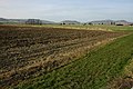
 Headland track, near Gotherington - geograph.org.uk - 1613126.jpg 640 × 426; 118 KB
-
 Nottingham Hill - geograph.org.uk - 1009615.jpg 640 × 426; 111 KB
-
 Nottingham Hill - geograph.org.uk - 1613144.jpg 640 × 426; 103 KB
-
 Nottingham Hill - geograph.org.uk - 613722.jpg 640 × 480; 38 KB
-
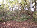 Nottingham Hill Fort Earthworks - geograph.org.uk - 79513.jpg 640 × 479; 184 KB
-

-
 Old quarry workings, Nottingham Hill - geograph.org.uk - 294262.jpg 640 × 480; 119 KB
-
 Rugby Pitches, Bishop's Cleeve - geograph.org.uk - 76392.jpg 640 × 479; 65 KB
-
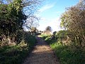 Sabrina Way Crossing Nottingham Hill - geograph.org.uk - 79523.jpg 640 × 479; 143 KB
-
 Stop Look Listen - geograph.org.uk - 1611727.jpg 640 × 426; 96 KB
-
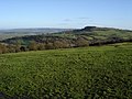 The northern slopes of Nottingham Hill - geograph.org.uk - 294268.jpg 640 × 480; 100 KB
-
 Waterlogged land near Elmstone Hardwicke - geograph.org.uk - 1611440.jpg 640 × 426; 127 KB
-
 Waterloo Farm, Stoke Orchard - geograph.org.uk - 79034.jpg 640 × 479; 68 KB
-
 Winter cereal and trees, Gotherington - geograph.org.uk - 1613124.jpg 640 × 426; 108 KB


