Category:Maps of the Netherlands
Jump to navigation
Jump to search
Countries of Europe: Albania · Andorra · Armenia‡ · Austria · Azerbaijan‡ · Belarus · Belgium · Bosnia and Herzegovina · Bulgaria · Croatia · Cyprus‡ · Czech Republic · Denmark · Estonia · Finland · France‡ · Georgia‡ · Germany · Greece · Hungary · Iceland · Republic of Ireland · Italy · Kazakhstan‡ · Latvia · Liechtenstein · Lithuania · Luxembourg · Malta · Moldova · Monaco · Montenegro · Netherlands‡ · North Macedonia · Norway · Poland · Portugal‡ · Romania · Russia‡ · San Marino · Serbia · Slovakia · Slovenia · Spain‡ · Sweden · Switzerland · Republic of Türkiye‡ · Ukraine · United Kingdom · Vatican City
Specific status: Akrotiri and Dhekelia‡ · Faroe Islands · Gibraltar · Bailiwick of Guernsey · Isle of Man · Jersey · Svalbard – Limited recognition: Abkhazia‡ · Gagauzia · Kosovo · South Ossetia‡ · Transnistria · Northern Cyprus‡ · United Nations Buffer Zone in Cyprus‡
‡: partly located in Europe
Specific status: Akrotiri and Dhekelia‡ · Faroe Islands · Gibraltar · Bailiwick of Guernsey · Isle of Man · Jersey · Svalbard – Limited recognition: Abkhazia‡ · Gagauzia · Kosovo · South Ossetia‡ · Transnistria · Northern Cyprus‡ · United Nations Buffer Zone in Cyprus‡
‡: partly located in Europe
English: See also en:Category:Maps of the Netherlands.
Français : Cartes des Pays-Bas.
Wikimedia category | |||||
| Upload media | |||||
| Instance of | |||||
|---|---|---|---|---|---|
| Category combines topics | |||||
 | |||||
Subcategories
This category has the following 25 subcategories, out of 25 total.
Pages in category "Maps of the Netherlands"
The following 2 pages are in this category, out of 2 total.
Media in category "Maps of the Netherlands"
The following 189 files are in this category, out of 189 total.
-
 2000px-Netherlands WP10.png 2,000 × 2,360; 217 KB
-
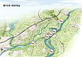 201026 definitieve versie brick valley met titel.jpg 5,803 × 4,064; 1.27 MB
-
 2012-NL-prov-relief-3000.jpg 3,000 × 3,440; 2.91 MB
-
 20120312122637!Noordenvelds.GIF 404 × 424; 61 KB
-
 2013-NL-Brandweer-1250.png 1,250 × 1,660; 529 KB
-
 2013-NL-GGD-1250.png 1,250 × 1,660; 425 KB
-
 2013-NL-GHOR-1250.png 1,250 × 1,658; 270 KB
-
 2013-NL-Reddingsbrigade-1250.png 1,250 × 1,660; 389 KB
-
 2014-GGD-1250.png 1,250 × 1,660; 371 KB
-
 2014-Reddingsbrigade-1250.png 1,250 × 1,660; 380 KB
-
 2014-Veiligheidsregios-1250.png 1,250 × 1,660; 403 KB
-
 2015-NL-GGD-1250.png 1,250 × 1,660; 339 KB
-
 2015-NL-Politie-1250.png 1,250 × 1,660; 314 KB
-
 2016-NL-Gemeenten-basis-2500px.png 2,500 × 2,910; 797 KB
-
 2016-NL-gemeenten-vol-4480px.jpg 4,480 × 5,333; 9.69 MB
-
 2017-NL-Gemeenten-basis-2500px.png 2,500 × 2,942; 784 KB
-
 2017-NL-gemeenten-vol-4480px.jpg 4,480 × 5,342; 9.95 MB
-
 2018-NL-Gemeenten-basis-2500px.png 2,500 × 2,961; 871 KB
-
 2018-NL-gemeenten-vol.jpg 6,995 × 8,182; 9.67 MB
-
 2018-Veiligheidsregio-1200.png 1,200 × 1,545; 285 KB
-
 2019-GGDregio-1200.png 1,200 × 1,545; 310 KB
-
 2019-NL-gemeenten-vol.jpg 5,380 × 6,417; 9.06 MB
-
 2019-Politie-prov-1200.png 1,200 × 1,547; 257 KB
-
 2019-Provincie-1200.png 1,200 × 1,547; 218 KB
-
 2019-Veiligheidsregio-1200.png 1,200 × 1,547; 298 KB
-
 2020-NL-Justitie-1250.png 1,250 × 1,660; 789 KB
-
 2022-Defensie-Regs-1200.png 1,200 × 1,545; 316 KB
-
 2022-GGD-Gem-1200.png 1,200 × 1,545; 356 KB
-
 2022-NL-Gemeenten-basis-2500px.png 2,500 × 2,944; 742 KB
-
 2022-Omgevingsdiensten-Gem-1200.png 1,200 × 1,545; 469 KB
-
 2022-Politieeenheden-1200.png 1,200 × 1,545; 234 KB
-
 2022-Veiligheidsregios-1200.png 1,200 × 1,545; 330 KB
-
 20220121 DM Overview2021 repatriation v2.pdf 1,754 × 1,239; 757 KB
-
 20220308 Modules deployed 2021.pdf 1,625 × 1,125; 961 KB
-
 2024 Omgevingsdiensten.jpg 1,100 × 1,416; 266 KB
-
 A0-voor-dichtbij-en-A0-voor-veraf.PNG 1,025 × 544; 66 KB
-
 Afdelingen JS november 2017.png 766 × 900; 251 KB
-
 Afvalverbrandingsinstallaties in Nederland.svg 870 × 924; 289 KB
-
 Map NL-A 01.jpg 179 × 179; 41 KB
-
-
 Bevolking leeftijd 2017 2040 regio 11122018 123555.png 1,280 × 525; 69 KB
-
 Bevolking migratieachtergrond en regio .png 1,280 × 1,615; 333 KB
-
 Blocksnethcontplat.jpg 547 × 908; 199 KB
-
 Backsteingotik Niederlande.png 1,528 × 1,653; 2.62 MB
-
 Buma-Stins.png 1,706 × 1,671; 4.91 MB
-
 Caravan Brandmeldingen isolijnen.png 713 × 862; 47 KB
-
 Caravan Brandmeldingen obv punten.png 714 × 867; 42 KB
-
 Chaff-Netherlands.png 400 × 400; 7 KB
-
 Chaff-Northsea.gif 256 × 256; 68 KB
-
 Concentratie gebieden Nederland.png 889 × 786; 108 KB
-
 Concept 7 provinces of 2014.png 1,000 × 1,180; 176 KB
-
 Concessies Nederland met Plaatsen.png 639 × 748; 158 KB
-
 Concessies Nederland.png 639 × 748; 203 KB
-
 Concessies spoorwegen nl.png 450 × 522; 53 KB
-
 Coropgebieden plain.png 1,027 × 1,195; 146 KB
-
 Danielm persoonlijk kaartje.png 237 × 253; 63 KB
-
 Detailed Flag Map of the Netherlands.png 4,685 × 5,270; 2.59 MB
-
 Diplomatic missions of the Netherlands.png 1,425 × 625; 42 KB
-
 Drente hoogtekaart met hunebeddenlocaties 300dpi.png 2,649 × 2,219; 7.72 MB
-
 ECDM 20131206 NorthernEurope SevereWeather.pdf 1,625 × 1,125; 716 KB
-
 ECDM 20140610 Europe SevereWeather.pdf 1,625 × 1,125; 503 KB
-
 ECDM 20140730 Europe SevereWeather.pdf 1,625 × 1,125; 396 KB
-
 ECDM 20141023 Europe SevereWeather.pdf 1,625 × 1,125; 659 KB
-
 ECDM 20231108 Southwest Europe Storm(1).pdf 2,479 × 1,754; 1.38 MB
-
 ECDM NorthernEurope SevereWeather 20141022.pdf 1,625 × 1,125; 450 KB
-
 ECHO The Netherlands Editable A4 Portrait.pdf 1,239 × 1,754; 176 KB
-
 Ecologische Hoofdstructuur.png 2,480 × 3,008; 492 KB
-
 ESC 2020 potential host cities and venues (as of 6 July 2019).svg 697 × 826; 1.52 MB
-
 Extreme points Netherlands.png 320 × 369; 19 KB
-
 ExtremepuntenNederland-10-10-10.png 320 × 369; 16 KB
-
 Hoofdcategorieeenbijgesneden2.jpg 16,096 × 19,296; 31.76 MB
-
 FLII Netherlands.png 894 × 813; 265 KB
-
 FLUTNH.png 200 × 235; 25 KB
-
 Geboorte kerncijfers per regio 29102018 093036.png 1,280 × 1,626; 277 KB
-
 Gemeentelijke herindelingen na 1812.png 7,267 × 6,739; 3.72 MB
-
 Gemeenten3150 1024px.gif 1,017 × 1,245; 812 KB
-
 Gemeenten3150 990px.gif 986 × 1,206; 729 KB
-
 Geografie acht zaligheden.jpg 1,080 × 1,313; 213 KB
-
 Guicciardini Map of Belgium and Netherlands.png 1,999 × 1,521; 5.61 MB
-
 Holandija mapa.jpg 558 × 600; 86 KB
-
 Hollandic Dialect Map.png 519 × 605; 19 KB
-
 Img by michiel1972 5.jpg 1,536 × 2,048; 916 KB
-
 Interpolated-best-estimate-maximum-permafrost-depth-map-for-the-0--C-isotherm.png 2,067 × 2,253; 776 KB
-
 Isla Bayoneta.png 833 × 857; 13 KB
-
 Islam in Netherlands.jpg 1,027 × 1,195; 264 KB
-

-
 Kaart van weegpunten in Nederland.jpg 1,000 × 1,202; 834 KB
-
 Kaartahc.jpg 417 × 475; 31 KB
-
 KAARTEN SGD - Kaart van uitgebreid technische scholen.jpeg 1,256 × 1,733; 157 KB
-

-
 KAARTEN SGD - Vierde nota over de ruimtelijke ordening.jpeg 2,232 × 3,118; 671 KB
-
 Kaderwetgebieden.png 450 × 421; 34 KB
-
 Karte Nord Niederlande Texel Marked.png 740 × 382; 104 KB
-

-
 Kolland en overlangbroek.png 193 × 220; 9 KB
-
 Landkaart 2020.jpg 2,101 × 2,496; 921 KB
-
 Landkaart gras nekkeveld.JPG 7,106 × 3,476; 11.44 MB
-
 Landsdeel.png 502 × 599; 67 KB
-
 Maasverlauf.jpg 643 × 933; 474 KB
-
 Map of the Netherlands nl.png 304 × 343; 12 KB
-
 Map provinces Netherlands-ar.jpg 927 × 1,103; 577 KB
-
 Map provinces Netherlands-ja.svg 743 × 881; 550 KB
-
 Mapa dos Países Baixos (OCHA).svg 254 × 254; 959 KB
-
 Meierij.jpg 638 × 864; 55 KB
-
 Menapii+ legende WIKI.png 3,747 × 3,415; 3.13 MB
-
 Navo-verantwoordelijkheidsgebied 2.png 381 × 400; 599 KB
-
 NDVI 062003.png 2,052 × 1,364; 480 KB
-
 NDVI 102003.png 2,052 × 1,364; 504 KB
-
 Nederland Burgemeesters.jpg 1,850 × 2,261; 1.68 MB
-
 Nederland Burgemeesters2.jpg 490 × 598; 106 KB
-
 Nederland neerslag metingen.png 705 × 826; 37 KB
-
 Nederland-10-10-10.png 885 × 975; 846 KB
-
 Nederlandse Burgemeesters Eigenschappen.png 4,640 × 5,474; 4.3 MB
-
 Nederlandse wijnbouw.svg 1,123 × 793; 7.27 MB
-
 Netherland map.jpg 220 × 237; 24 KB
-
 Netherland.png 505 × 599; 219 KB
-
 NetherlandButtonClick.PNG 350 × 404; 33 KB
-
 Netherlands - DPLA - 8fd69a59a7652d718d7a4aae2fe39962.jpg 2,554 × 3,278; 5.69 MB
-
 Netherlands - DPLA - cedd8970ef28004500f4e4006a3166b8.jpg 2,546 × 3,276; 6.19 MB
-
 Netherlands colour.png 800 × 948; 87 KB
-
 Netherlands DNI Solar-resource-map GlobalSolarAtlas World-Bank-Esmap-Solargis.png 1,842 × 2,605; 1.13 MB
-
 Netherlands GHI Solar-resource-map GlobalSolarAtlas World-Bank-Esmap-Solargis.png 1,842 × 2,605; 1.1 MB
-
 Netherlands map large dutch-10-10-10.png 800 × 948; 246 KB
-
 Netherlands map large-10-10-10.png 1,200 × 1,423; 471 KB
-
 Netherlands Population Density and Low Elevation Coastal Zones (5457306871).jpg 3,255 × 2,472; 1.06 MB
-

-
 Netherlands regions map (cs).png 1,559 × 1,790; 1.03 MB
-
 Netherlands Settlement Points (6172884188).jpg 2,373 × 3,188; 748 KB
-
 Netherlands Unemployment.png 842 × 1,191; 132 KB
-
 Netherlands Urban Extents (6172572462).jpg 2,384 × 3,189; 717 KB
-
 Netherlands water.png 400 × 400; 55 KB
-
 Netherlands with provinces.png 200 × 235; 23 KB
-
 Netherlands without provinces.png 200 × 235; 17 KB
-
 Netherlands-303419 960 720.webp 607 × 720; 68 KB
-
 Netherlands-map.png 5,000 × 5,891; 4.04 MB
-
 Netherlands1559.jpg 768 × 1,088; 312 KB
-
 NL LASA.gif 240 × 286; 17 KB
-
 NL osm Oost.png 963 × 1,159; 526 KB
-
 NL osm Zuid.png 1,253 × 817; 576 KB
-
 NormtrajectenDelta.jpg 650 × 915; 223 KB
-
 NormtrajectenMaas.jpg 650 × 916; 151 KB
-
 NormtrajectenMidden.jpg 650 × 458; 138 KB
-
 NormtrajectenNoord.jpg 650 × 457; 120 KB
-

-
 Oostelijke Ontsluiting IJburg 2020.jpg 1,740 × 1,856; 5.31 MB
-
 Overzicht locaties luchtwachttorens in Nederland.jpg 876 × 984; 104 KB
-
 Paesi Bassi con città con presenza di ndrangheta (2017).jpg 755 × 847; 167 KB
-
 Païses basses.jpg 800 × 948; 107 KB
-
 PDF Al het water.pdf 4,966 × 7,020; 59.22 MB
-
 PM10 dagoverschrijdingen in Nederland 2006.jpg 720 × 960; 67 KB
-
 Principado de Orange mapa.PNG 454 × 410; 12 KB
-
 Provinces of Brabant.png 453 × 678; 35 KB
-
 Provinces of the Netherlands.svg 200 × 236; 159 KB
-
 Provincies relief 1440px.gif 1,440 × 1,760; 1.54 MB
-
 Provincies relief 1440px.png 1,440 × 1,760; 2.54 MB
-
 Rain radar (cropped).jpeg 216 × 144; 24 KB
-
 Rain radar.jpeg 216 × 171; 37 KB
-
 Reception UMTS of KPN Netherlands.PNG 776 × 891; 85 KB
-
 Reiderland kaart.png 5,632 × 4,369; 40.25 MB
-
 Relief Westfaelische Bucht.png 5,105 × 3,338; 13.62 MB
-
 Resolutie vergelijking 300dpi 100dpi 30dpi.PNG 1,280 × 960; 172 KB
-
 Rijnmondkaart.png 1,307 × 1,005; 227 KB
-
 Shops Nederland.png 685 × 766; 85 KB
-
 Skoep meldingen Op openstreetmap.PNG 616 × 695; 369 KB
-
 Slim gebruik maken van GIS model Steden gelabeld.PNG 1,885 × 710; 81 KB
-
 Staande mast route.PNG 580 × 772; 77 KB
-

-
 Stadsportalen in Nederland.png 534 × 616; 55 KB
-
 The Netherlands below sealevel and protected from floods.png 962 × 1,003; 591 KB
-
 The Netherlands compared to sealevel.png 962 × 1,003; 25 KB
-
 Topografie Nederland.jpg 300 × 342; 16 KB
-
 Toponl.PNG 300 × 342; 27 KB
-
 Two stag beetles crawling over a map of the world underneath Wellcome V0022824.jpg 2,979 × 3,683; 5.05 MB
-
 United Kingdom of the Netherlands.png 800 × 550; 81 KB
-
 Valversnelling in Nederland.svg 538 × 540; 674 KB
-
 VanDobbenKaartVogeltrek1934.png 920 × 870; 880 KB
-
 Verspreiding Prijt-Priet in 1947.gif 558 × 666; 53 KB
-
 VG130N.Omg.C2,D2 Reusel 180x240 9,7MB.jpg 5,104 × 6,806; 9.2 MB
-
 Vidal-lablache 425482-1.jpg 3,600 × 4,379; 4.7 MB
-
 Vidal-lablache 425482-2.jpg 3,344 × 3,880; 4.62 MB
-
 Voorbeeld labelling Halo aan halo uit.PNG 361 × 211; 11 KB
-
 Waarschuwingsregio's Nederland.png 502 × 599; 77 KB
-

-

-
 Waterschappen-public-600.gif 600 × 763; 218 KB
-
 Werkloosheid in Nederland in 2006.png 408 × 417; 46 KB
-
 Wiki NL PCs.png 4,961 × 7,013; 1.96 MB
-
 World Factbook (1990) Netherlands.jpg 552 × 544; 91 KB
-
 Zuiderzee.gif 290 × 340; 6 KB


.svg)


.svg)


.jpg)

.png)
.jpg)

.jpg)


.svg)


.jpg)


.jpeg)


.jpg)


_Netherlands.jpg)
