Category:Koningin Emmaplein (Rotterdam)
Jump to navigation
Jump to search
| Object location | | View all coordinates using: OpenStreetMap |
|---|
street in Rotterdam, the Netherlands _2022.jpg) | |||||
| Upload media | |||||
| Instance of | |||||
|---|---|---|---|---|---|
| Named after | |||||
| Location | Rotterdam, South Holland, Netherlands | ||||
| Street address |
| ||||
| Has part(s) | |||||
| Inception |
| ||||
 | |||||
|
This is a category about rijksmonument number 513898
|
| Address |
|
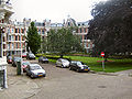
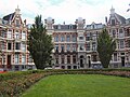
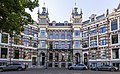
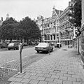
Media in category "Koningin Emmaplein (Rotterdam)"
The following 14 files are in this category, out of 14 total.
-
 Gezicht op het Koningin Emmaplein te Rotterdam met figuren, objectnr 66613.JPG 4,961 × 2,694; 10.68 MB
-

-
 Emmaplein.jpg 1,744 × 1,308; 703 KB
-
 Emmaplein1.jpg 1,744 × 1,308; 653 KB
-
 Koningin Emmaplein (Rotterdam) 2022.jpg 4,974 × 3,074; 9.66 MB
-
 Koningin Emmaplein 3-14, juli 2022.tif 5,443 × 3,364; 104.81 MB
-
 Nieuwe Werk, Rotterdam, Netherlands - panoramio (53).jpg 4,896 × 3,264; 2.46 MB
-
 Overzicht - Rotterdam - 20192017 - RCE.jpg 1,183 × 1,200; 334 KB
-
 Overzicht - Rotterdam - 20192019 - RCE.jpg 1,200 × 1,197; 334 KB
-
 Rotterdam koningin emma plein.jpg 2,800 × 1,904; 703 KB
-
 Siervaas Berlage.jpg 1,436 × 1,125; 685 KB
-
 Voorgevels - Rotterdam - 20192018 - RCE.jpg 1,200 × 1,197; 341 KB
-
 Westzeedijk Koningin Emmaplein Rotterdam 2018.jpg 4,928 × 3,264; 6.74 MB
-
 WLM - EvaM1978 - Kon. Emmaplein R'dam..jpg 1,024 × 685; 411 KB


.jpg)


