Category:Havezate De Haere (Olst)
Jump to navigation
Jump to search
| Object location | | View all coordinates using: OpenStreetMap |
|---|
 | |||||
| Upload media | |||||
| Instance of | |||||
|---|---|---|---|---|---|
| Location | Olst, Overijssel, Netherlands | ||||
| Has part(s) | |||||
| Heritage designation |
| ||||
 | |||||
|
This is a category about rijksmonumentcomplex number 530428
|
Landhuis:
|
This is a category about rijksmonument number 530429
|
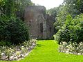
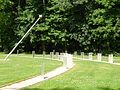
Historische tuin- en parkaanleg:
|
This is a category about rijksmonument number 530430
|
Jachthuis, Koetshuis, Paardenstal:
|
This is a category about rijksmonument number 530431
|
Boerderij, muur en stenen schuur:
|
This is a category about rijksmonument number 530432
|
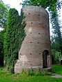
Parkruine als folly:
|
This is a category about rijksmonument number 530433
|
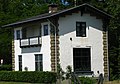
Rentmeesterwoning:
|
This is a category about rijksmonument number 530434
|
Voormalig tolhuis:
|
This is a category about rijksmonument number 530435
|
Entreepijlers:
|
This is a category about rijksmonument number 530436
|
| Address |
|
Subcategories
This category has the following 2 subcategories, out of 2 total.
I
- IJssellinie (Olst) (47 F)
R
- Rijksstraatweg 10, Olst (8 F)
Media in category "Havezate De Haere (Olst)"
The following 36 files are in this category, out of 36 total.
-
 20150706 De Haere achterzijde.jpg 4,896 × 3,672; 2.41 MB
-
 20150706 De Haere folly ruine1.jpg 3,672 × 4,896; 2.95 MB
-
 20150706 De Haere folly ruine2.jpg 4,896 × 3,672; 2.69 MB
-
 20150706 De Haere folly ruine3.jpg 3,672 × 4,896; 2.23 MB
-
 20150706 De Haere zonnewijzer.jpg 4,896 × 3,672; 1.8 MB
-
 20150706 De Haere1.jpg 4,896 × 3,672; 1.72 MB
-
 20150706 De Haere2.jpg 4,896 × 3,672; 1.39 MB
-
 Achtergevel en water - Olst - 20172964 - RCE.jpg 1,200 × 894; 222 KB
-
 De Haere folly.jpg 2,148 × 1,476; 814 KB
-
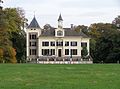
 De Haere.jpg 2,154 × 1,476; 570 KB
-
 Exterieur aanzicht naar het noord-oosten - Olst - 20172962 - RCE.jpg 1,200 × 952; 335 KB
-
 Haereweg2.jpg 2,959 × 2,070; 821 KB
-
 Huis De Haere.JPG 1,656 × 952; 409 KB
-
 IJssellinie Bunker.JPG 640 × 480; 138 KB
-
 Olst - De Haere -2012 - 001.JPG 3,888 × 2,592; 4.74 MB
-
 Olst - De Haere -2012 - Vooraanzicht - 2.JPG 3,888 × 2,592; 4.95 MB
-
 Olst - De Haere -2012 - Vooraanzicht.JPG 3,888 × 2,592; 4.49 MB
-
 Olst - De Haere -2012 - Zijaanzicht.JPG 2,592 × 3,888; 6.18 MB
-
 Olst - De Haere -2012 -004.JPG 2,592 × 3,888; 3.08 MB
-
 Olst - De Haere -2012-003.JPG 3,888 × 2,592; 4.59 MB
-
 Olst De Haere 1.jpg 3,632 × 2,702; 2.82 MB
-
 Olst De Haere 2.jpg 3,530 × 2,724; 2.86 MB
-
 Olst De Haere Folly.JPG 4,000 × 3,000; 4.73 MB
-
 Olst De Haere Koetshuis.jpg 3,564 × 2,688; 3.33 MB
-
 Olst De Haere Rentmeestershuis.jpg 3,456 × 2,710; 2.51 MB
-
 Olst De Haere Tuinaanleg.JPG 2,736 × 3,648; 3.58 MB
-
 Olst haere.jpg 2,731 × 1,983; 1.18 MB
-
 Olst rijksstraatweg 8.JPG 3,072 × 2,304; 1.14 MB
-
 Olst, De Haere RM530428.jpg 3,648 × 2,736; 4.88 MB
-
 Overzicht - Olst - 20172965 - RCE.jpg 894 × 1,200; 249 KB
-
 Vooraanzicht naar het zuid-oosten - Olst - 20172963 - RCE.jpg 1,200 × 941; 313 KB
-
 Voormalig rentmeesterhuis van het huis "De Haere" - Olst - 20173015 - RCE.jpg 1,200 × 953; 238 KB
-
 Voormalig rentmeesterhuis van het huis "De Haere" - Olst - 20173016 - RCE.jpg 1,200 × 953; 244 KB
-
 Voormalig rentmeesterhuis van het huis "De Haere" - Olst - 20173017 - RCE.jpg 1,200 × 953; 364 KB
-
 Voormalig tolhuis, overzicht - Olst - 20173022 - RCE.jpg 1,200 × 943; 292 KB
-
 Voormalig tolhuis, voor- en zijgevel - Olst - 20173023 - RCE.jpg 1,200 × 943; 275 KB


