Category:Harsta State
Jump to navigation
Jump to search
| Object location | | View all coordinates using: OpenStreetMap |
|---|
 | |||||
| Upload media | |||||
| Instance of | |||||
|---|---|---|---|---|---|
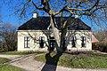
| Location | Hegebeintum, Noardeast-Fryslân, Friesland, Netherlands | ||||
| Has part(s) | |||||
| Heritage designation |
| ||||
 | |||||
Nederlands: Harsta State, Harstawei 25, Hegebeintum, Ferwerderadiel, Friesland (rmc 508264). Dit rijksmonumentcomplex bestaat uit:
- Harsta State (rm 508263)
- park/tuin (rm 508265)
- hekpijlers (rm 508266)
|
This is a category about rijksmonumentcomplex number 508264
|
|
This is a category about rijksmonument number 508263
|
|
This is a category about rijksmonument number 508265
|
|
This is a category about rijksmonument number 508266
|
Subcategories
This category has the following 2 subcategories, out of 2 total.
H
- Harsta State historical views (63 F)
S
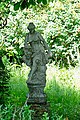
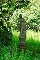
- Sculptures at Harsta State (13 F)
Media in category "Harsta State"
The following 42 files are in this category, out of 42 total.
-
 20200603 Harstastate1.jpg 5,184 × 3,456; 5.61 MB
-
 20200603 Harstastate2.jpg 4,999 × 3,332; 5.01 MB
-
 20200603 Harstastate3.jpg 5,184 × 3,456; 5.76 MB
-
 20200603 leeuw2 Harstastate.jpg 3,456 × 5,184; 3.9 MB
-
 20200603 leeuw3 Harstastate.jpg 3,456 × 5,184; 3.48 MB
-
 20200603 leeuw4 Harstastate.jpg 3,456 × 5,184; 4.68 MB
-
 20200603 leeuwen Harstastate.jpg 3,456 × 5,184; 4.36 MB
-
 20200603 tuinbeeld1 Harstastate.jpg 3,456 × 5,184; 4.75 MB
-
 20200603 tuinbeeld2 Harstastate.jpg 3,456 × 5,184; 5.2 MB
-
 20200603 tuinbeeld3 Harstastate.jpg 3,456 × 5,184; 4.92 MB
-
 20200603 tuinbeeld4 Harstastate.jpg 3,294 × 4,942; 3.13 MB
-
 20200603 tuinvaas Harstastate.jpg 3,456 × 5,184; 4.4 MB
-
 2023 Hegebeintum, Harsta State.jpg 3,469 × 2,313; 5.45 MB
-
 2023 Hegebeintum, Harstastate.jpg 3,830 × 2,550; 7.97 MB
-
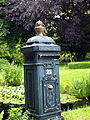 Brievenbus nr. 25 Harsta State..JPG 3,024 × 4,032; 2.41 MB
-
 De andere toegang van Harsta State..JPG 3,543 × 2,651; 2.22 MB
-
 Harsta State hek.jpg 1,824 × 1,368; 980 KB
-
 Harsta State tuin.jpg 1,824 × 1,368; 1,012 KB
-
 Harsta State tuinbeeld1.jpg 1,824 × 1,368; 934 KB
-
 Harsta State1.jpg 1,824 × 1,368; 968 KB
-
 Harstastate Hegebeintum (actm) 01.jpg 4,503 × 2,569; 12.48 MB
-
 Harstastate Hegebeintum (actm) 02.jpg 4,887 × 2,750; 8.03 MB
-
 Harstastate Hegebeintum (actm) 03.jpg 4,979 × 2,790; 13.82 MB
-
 Harstastate Hegebeintum (actm) 04.jpg 5,034 × 1,720; 9.25 MB
-
 Harstastate Hegebeintum (actm) 05.jpg 2,325 × 3,412; 9.5 MB
-
 Harstastate Hegebeintum (actm) 06.jpg 3,324 × 4,689; 10.75 MB
-
 Harstastate Hegebeintum (actm) 07.jpg 3,080 × 4,544; 15.76 MB
-
 Harstastate Hegebeintum (actm) 08.jpg 5,184 × 3,456; 20.73 MB
-
 Harstastate Hegebeintum (actm) 09.jpg 3,163 × 3,602; 6.75 MB
-
 Harstastate Hegebeintum (actm) 10.jpg 4,270 × 2,905; 11.37 MB
-
 Harstastate Hegebeintum (actm) 11.jpg 4,134 × 1,487; 7.33 MB
-
 Harstastate Hegebeintum (actm) 12.jpg 4,236 × 3,177; 12.1 MB
-
 Harstastate Hegebeintum (actm) 13.jpg 3,044 × 4,640; 6.99 MB
-
 Harstastate Hegebeintum (actm) 14.jpg 3,384 × 4,993; 14.52 MB
-
 HarstaState.JPG 1,600 × 1,200; 896 KB
-
 Hogebeintum, Harsta State 1978 RM508263.jpg 4,704 × 2,916; 7.74 MB
-
 Hogebeintum, Harsta State met eigenaar dhr Obreen 1978 RM508263.jpg 2,638 × 1,702; 6.14 MB
-
 Hogebeintum, Harsta State mrt 1983 RM508263.jpg 2,498 × 1,703; 6.05 MB
-
 Hogebeintum, Harsta State RM508263.jpg 3,648 × 2,736; 9.54 MB
-
 Mooi hekwerk Harsta State..JPG 3,024 × 4,032; 2.65 MB
-
 Toegang Harsta State..JPG 4,032 × 3,024; 2.26 MB
-
 Voor Harsta State..JPG 3,024 × 4,032; 2.49 MB


_01.jpg)
_02.jpg)
_03.jpg)
_05.jpg)
_06.jpg)
_07.jpg)
_08.jpg)
_09.jpg)
_10.jpg)
_12.jpg)
_13.jpg)
_14.jpg)


_04.jpg)
_11.jpg)