Category:Ginneken
Jump to navigation
Jump to search
| Camera location | | View all coordinates using: OpenStreetMap |
|---|
{{nl|Afbeeldingen van de wijk het Ginneken in het zuiden van Breda in de provincie Noord-Brabant in het zuiden van Nederland. Het Ginneken is nabij de wijken Ruitersbos en Ulvenhout en het Markdal en het Mastbos. (bron [1];[2];[3];[4];[5])
neighborhood in Breda, the Netherlands   | |||||
| Upload media | |||||
| Instance of |
| ||||
|---|---|---|---|---|---|
| Location | Breda, North Brabant, Netherlands | ||||
 | |||||
Subcategories
This category has the following 27 subcategories, out of 27 total.
B
- Buitenplaats Marckhoek (6 F)
C
- Carmel's White House (Breda) (6 F)
D
- Dorpspomp (Ginneken) (10 F)
G
- Gemeenschapshuis Vianden (5 F)
H
K
- Kasteel Daasdonk (2 F)
L
- Laurensziekenhuis (17 F)
M
- Maps of Ginneken (2 F)
O
- Oude Raadhuis (Ginneken) (19 F)
R
S
V
- Vereniging IJsvermaak Breda (7 F)
- Videos of Ginneken (3 F)
- Villa Mon Plaisir (21 F)
- Vrederust (Breda) (4 F)
- Vrijlandtbrug (13 F)
Media in category "Ginneken"
The following 9 files are in this category, out of 9 total.
-
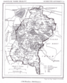 1869 Ginneken.png 1,318 × 1,633; 340 KB
-
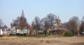 Bredaginneken.jpg 500 × 265; 83 KB
-
 E.S. Heynincx Huis Mariendal Ginneken elevation 1.jpg 883 × 403; 47 KB
-
 E.S. Heynincx Huis Mariendal Ginneken elevation 2.jpg 647 × 381; 33 KB
-
 En put - Ginneken - 20078588 - RCE.jpg 1,200 × 804; 221 KB
-
 Flag of Ginneken en Bavel.svg 450 × 300; 557 bytes
-
 François Colson in zijn werkkamer.jpg 742 × 558; 64 KB
-
 Ginneken en Bavel COA.png 225 × 264; 6 KB
-
 Pomp - Ginneken - 20078664 - RCE.jpg 788 × 1,200; 205 KB


