Category:Featured maps
Jump to navigation
Jump to search
Wikimedia category | |||||
| Upload media | |||||
| Instance of | |||||
|---|---|---|---|---|---|
| |||||
Subcategories
This category has the following 2 subcategories, out of 2 total.
F
- Featured maps of Paris (26 F)
R
- Featured maps of Russia (1 F)
Pages in category "Featured maps"
This category contains only the following page.
Media in category "Featured maps"
The following 48 files are in this category, out of 48 total.
-
 1375 Atlas Catalan Abraham Cresques.jpg 11,811 × 3,850; 23.67 MB
-
 1580 Lucas Janszoon Waghenaer Carte de l'ouest de la bretagne.jpg 6,312 × 4,208; 16.89 MB
-
 1794 Samuel Dunn Wall Map of the World in Hemispheres - Geographicus - World2-dunn-1794.jpg 6,000 × 5,054; 8.92 MB
-
 Abkhazia map-fr.svg 945 × 737; 813 KB
-
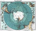 Antarctica 1912 edit.jpg 4,940 × 4,296; 17.94 MB
-

-
-
 Bartolomeu Velho 1568.jpg 3,255 × 2,402; 6.21 MB
-
 Batalla-ter.jpg 8,367 × 6,167; 16.56 MB
-
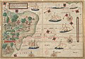 Brazil 16thc map.jpg 14,028 × 9,829; 33.51 MB
-
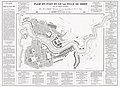 Btv1b530849639 plan du port et de la ville de Brest 1855 restored.jpg 9,526 × 6,928; 42.49 MB
-
 1581 Bunting clover leaf map.jpg 4,441 × 3,496; 14.36 MB
-
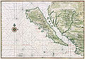 California island Vinckeboons5.jpg 8,359 × 5,800; 39.02 MB
-
 Carte de Brest - ca 1700 - Bibliothèque Nationale de France - Btv1b8439976x.jpg 4,948 × 3,624; 12.86 MB
-
 Carte du cours du Rhône de Genève à Lyon - 1787.jpg 5,823 × 6,096; 17.78 MB
-
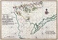
 Claude Bernou Carte de lAmerique septentrionale.jpg 3,841 × 3,641; 5.86 MB
-
 Corsica-geographic map-fr.svg 2,200 × 4,030; 14.15 MB
-
 CzechRepublic-geographic map-en.svg 1,949 × 1,200; 14.56 MB
-
 Daedongyeojido-full.jpg 17,837 × 30,000; 99.08 MB
-
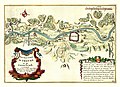 De Fer Trier 1692.jpg 7,101 × 5,168; 30.14 MB
-
 Delaware Bay Vinckeboons 14.jpg 8,382 × 5,888; 34.25 MB
-
 EB&EC Kellogg Brothers, Illustrative Map of Human Life, 1847 Cornell CUL PJM 1054 01.jpg 3,086 × 4,295; 4.39 MB
-
 Ethel Franklin Betts, Save the Survivors, 1918 Cornell CUL PJM 2029 01.jpg 4,000 × 3,029; 2.1 MB
-
 Ethnographic map of austrian monarchy czoernig 1855.jpg 7,997 × 5,862; 23.73 MB
-
 Florida topographic map-en.svg 2,890 × 2,810; 2.51 MB
-
 Georgin François, The 3 Roads to Eternity, 1825 Cornell CUL PJM 1040 01.jpg 5,000 × 3,318; 5.34 MB
-
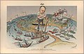
 Henry Mayer, The Awakening, 1915 Cornell CUL PJM 1176 01 - Restoration.jpg 9,045 × 6,003; 36.57 MB
-
 Hispaniola Vinckeboons4.jpg 8,594 × 6,055; 32.07 MB
-
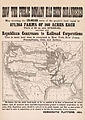 How The Public Domain Has Been Squandered 1884 Cornell CUL PJM 1088.jpg 6,600 × 9,300; 12.12 MB
-
 IAN 0134 Bellin 1797 Ionian Sea.jpg 2,977 × 3,882; 12.03 MB
-

-
 Jorge Aguiar 1492 MR.jpg 5,016 × 3,878; 13.06 MB
-
 Kunyu Wanguo Quantu (坤輿萬國全圖).jpg 11,726 × 5,266; 16.75 MB
-
 Map of Europe, 1946 (25289557032).jpg 5,367 × 4,017; 3.32 MB
-
 Map of Hindoostan, 1788, by Rennell.jpg 14,638 × 12,501; 67.82 MB
-
 Michelangelo Caetani, Overview of the Divine Comedy, 1855 Cornell CUL PJM 1071 01.jpg 4,748 × 6,391; 5.64 MB
-
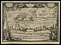
 Mortier, Situation du Paradise Terrestre, 1700 Cornell CUL PJM 1014 01.jpg 8,818 × 7,844; 7.87 MB
-
 Moxon A Map of the Earth 1681 Cornell CUL PJM 1012 01.jpg 8,940 × 7,127; 8.96 MB
-
 New York state geographic map-en.svg 2,811 × 2,000; 18.34 MB
-

-
 Plan et vue du port ville et chateau de Brest ca 1700.jpg 5,752 × 7,822; 34.75 MB
-
 Public Roads of the contiguous United States, from the 2018 TIGER GIS dataset.png 16,668 × 10,249; 138.99 MB
-
 Sitting Leo Belgicus - Visscher.jpg 3,500 × 2,886; 3.36 MB
-
 The seat of war in the West Indies 1740.jpg 7,522 × 6,504; 11.88 MB
-
 Victor Gillam A Thing Well Begun Is Half Done 1899 Cornell CUL PJM 1136 01.jpg 4,000 × 2,593; 2.64 MB
-
 Visscher Die Gelegenheit Des Paradeis 1665 Cornell CUL PJM 2004 01.jpg 8,029 × 6,295; 7.58 MB
-
 Waldseemuller map 2.jpg 13,708 × 7,590; 19.65 MB
-
 Wright The Journey of Life 1775 Cornell CUL PJM 1025 01.jpg 5,112 × 8,549; 8.46 MB


.jpg)
.jpg)


.jpg)
.jpg)


