Category:Doornburgh (Maarssen)
Jump to navigation
Jump to search
| Object location | | View all coordinates using: OpenStreetMap |
|---|
 | |||||
| Upload media | |||||
| Instance of |
| ||||
|---|---|---|---|---|---|
| Location | Maarssen, Utrecht, Netherlands | ||||
| Architect | |||||
| Has part(s) | |||||
| Heritage designation |
| ||||
| official website | |||||
 | |||||
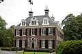
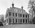
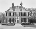
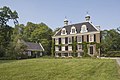
Nederlands: Doornburgh, ook wel Doornenburg, is een in de 17e eeuw aan de Vecht in Maarssen ontstane buitenplaats
|
This is a category about rijksmonumentcomplex number 527406
|
Landhuis
|
This is a category about rijksmonument number 527407
|
Historische aanleg
|
This is a category about rijksmonument number 527408
|
Bijgebouw
|
This is a category about rijksmonument number 527409
|
Koetshuis
|
This is a category about rijksmonument number 527410
|
Toegangshek
|
This is a category about rijksmonument number 527411
|
Toegangshek
|
This is a category about rijksmonument number 527412
|
Tuinhekje
|
This is a category about rijksmonument number 527415
|
Bijgebouw
|
This is a category about rijksmonument number 527416
|
| Address |
|
Subcategories
This category has the following 6 subcategories, out of 6 total.
Media in category "Doornburgh (Maarssen)"
The following 45 files are in this category, out of 45 total.
-
 Begraafplaats landgoed Doornburgh.jpg 3,264 × 2,176; 3.44 MB
-
 Detail hek aan de Diependaalsedijk - Maarssen - 20143475 - RCE.jpg 1,200 × 1,200; 251 KB
-
 Detail-tuindoornburgh.jpg 3,744 × 5,616; 5.86 MB
-
 Dienstwoningen - Maarssen - 20143464 - RCE.jpg 1,200 × 815; 284 KB
-
 Doornburgh te Maarssen entree vanaf Diependaalsedijk met tuinmuur.jpg 3,264 × 2,448; 3.62 MB
-
 Doornburgh te Maarssen hekwerk aan de Diependaalsedijk.jpg 3,264 × 2,448; 3.89 MB
-
 Doornburgh te Maarssen historische tuin en parkaanleg.jpg 2,448 × 3,264; 3.37 MB
-
 Doornburgh te Maarssen met poortgebouw en tuinmuur.jpg 3,264 × 2,448; 3.74 MB
-
 Hek - Maarssen - 20143614 - RCE.jpg 1,193 × 1,200; 493 KB
-
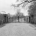
 Hek Diependaalsedijk - Maarssen - 20143613 - RCE.jpg 1,178 × 1,200; 363 KB
-
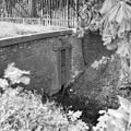 Houten schuif in gemetselde dam - Maarssen - 20143474 - RCE.jpg 1,200 × 1,200; 399 KB
-
 HUA-135597-Gezicht op de tuin en de voorgevel van het huis Doornburg te Maarssen.jpg 3,717 × 3,013; 4.82 MB
-
 HUA-135701-Gezicht op de tuin en de voorgevel van het huis Doornburg te Maarssen.jpg 3,792 × 3,064; 5.22 MB
-
 HUA-201192-Gezicht op de tuin en de voorgevel van het huis Doornburg te Maarssen.jpg 2,197 × 1,762; 1.26 MB
-

-
 Interieur begane grond, fontein in de gang - Maarssen - 20340091 - RCE.jpg 970 × 1,200; 190 KB
-
-
 Interieur kamer met plafondschildering - Maarssen - 20340088 - RCE.jpg 1,200 × 970; 265 KB
-
 Interieur kamer met schouw - Maarssen - 20340087 - RCE.jpg 970 × 1,200; 272 KB
-
 Interieur kamer, detail hoekornament - Maarssen - 20340089 - RCE.jpg 1,181 × 1,200; 300 KB
-

-
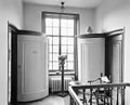
 Interieur, overzicht hal - Maarssen - 20340085 - RCE.jpg 1,200 × 970; 212 KB
-
 Laag hek van smeedijzer - Maarssen - 20340081 - RCE.jpg 1,186 × 1,200; 411 KB
-
 Maarsen-doornburghdetail.jpg 2,000 × 3,000; 3.26 MB
-
 Maarsen-RM26349.jpg 5,616 × 3,744; 8.24 MB
-
 Maarssen 26348 Diependaalsedijk 15.JPG 3,072 × 2,304; 1.36 MB
-
 Maarssen, doornburghdetail.jpg 5,616 × 3,744; 5.95 MB
-
 Maarssen-doornburgh-achterzijde.jpg 5,616 × 3,744; 5.78 MB
-
 Maarssen-doornburghachterkant.jpg 2,000 × 3,000; 2.77 MB
-
 Maarssen-doornburghdetail.jpg 2,000 × 3,000; 4.11 MB
-
 Maarssen-LandhuisDoornburgh.jpg 5,616 × 3,744; 5.47 MB
-
 Overzicht achtergevel - Maarssen - 20340077 - RCE.jpg 1,200 × 970; 299 KB
-
 Overzicht linker zijgevel - Maarssen - 20340076 - RCE.jpg 1,200 × 970; 350 KB
-
 Overzicht rechter zijgevel - Maarssen - 20340075 - RCE.jpg 1,200 × 964; 297 KB
-
 Overzicht voorgevel - Maarssen - 20143460 - RCE.jpg 1,200 × 894; 274 KB
-
 Overzicht voorgevel - Maarssen - 20340074 - RCE.jpg 1,200 × 970; 279 KB
-
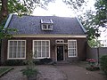
 Overzicht voorgevel gastenverblijf Doornburgh - Maarssen - 20418550 - RCE.jpg 1,200 × 800; 228 KB
-
 Plafondschildering - Maarssen - 20143457 - RCE.jpg 1,200 × 968; 153 KB
-
 Schouw afkomstig uit Utrecht - Maarssen - 20143458 - RCE.jpg 965 × 1,200; 192 KB
-
 Smeedijzeren hek aan de Diependaalsedijk - Maarssen - 20340082 - RCE.jpg 1,185 × 1,200; 508 KB
-
 Tuinmuur aan de Diependaalsedijk - Maarssen - 20143473 - RCE.jpg 1,200 × 1,195; 350 KB
-
 Verrijzende Christus door René van Seumeren.jpg 1,440 × 1,920; 1.12 MB
-
 Voorgevel - Maarssen - 20143462 - RCE.jpg 1,200 × 804; 263 KB
-
 Voorgevel van bijgebouw - Maarssen - 20340079 - RCE.jpg 1,200 × 970; 386 KB
-
 Zijgevel huis - Maarssen - 20143463 - RCE.jpg 1,200 × 801; 296 KB


