Category:Circumpolar maps
Jump to navigation
Jump to search
map including a pole _-_Essd-15-541-2023-f01-web.png) | |||||
| Upload media | |||||
| Subclass of | |||||
|---|---|---|---|---|---|
| |||||
Media in category "Circumpolar maps"
The following 42 files are in this category, out of 42 total.
-
-
 Arctic (orthographic projection with highlights).svg 512 × 512; 412 KB
-
 Arctic (orthographic projection).svg 553 × 553; 329 KB
-
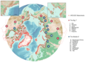
 Arctic Council map.png 800 × 800; 68 KB
-
 Arctic Council.png 800 × 800; 76 KB
-
 Arctic Council.svg 553 × 553; 3.46 MB
-
 Arctic Ocean CIA map PL.png 329 × 330; 14 KB
-
 Arctic Ocean Currents.svg 3,409 × 3,387; 752 KB
-
 Arctic Ocean location map 2.svg 708 × 708; 466 KB
-
 Arctic Ocean location map.svg 709 × 708; 589 KB
-
 Arctic Ocean relief location map.png 1,181 × 1,181; 2.19 MB
-
 Arctic Ocean Seaports.png 488 × 787; 25 KB
-
 Arctic Ocean SVG.svg 709 × 708; 590 KB
-
 Arctic Ocean.jpg 4,555 × 3,974; 6.66 MB
-
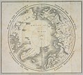
 Chart of the Arctic regions from the Admiralty surveys. Third edition. RMG F0461.tiff 6,158 × 6,035; 106.33 MB
-
 Chart of the North Polar Sea. RMG F6344.tiff 6,331 × 6,400; 115.92 MB
-
 Chart of the North Polar Sea. RMG F9897.tiff 5,318 × 5,250; 79.88 MB
-
-
 Desglaç artic.svg 807 × 1,026; 126 KB
-
 Fridtiof Nansen, 1861-1893 (1896) (14595870127).jpg 2,240 × 2,296; 554 KB
-
 Ibca gebco comp cover.jpg 1,024 × 1,024; 1.15 MB
-
 Jan Mayen orthographic.png 488 × 487; 12 KB
-
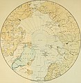
 Map of the arctic regions (14251165318).jpg 1,831 × 2,000; 1.27 MB
-
-
 Nansen's Planned Drift map-de.svg 496 × 490; 1.24 MB
-
 Nansen's Planned Drift map-fr.svg 1,335 × 1,335; 1.94 MB
-
 Nansen's Planned Drift Map.PNG 331 × 332; 25 KB
-
 Nansen's Planned Drift map.svg 496 × 490; 1.29 MB
-

-
 Noordpool centraal vanuit ruimte bol canada centraal.PNG 743 × 733; 29 KB
-
 Noordpool centraal vanuit ruimte bol europa centraal.PNG 752 × 754; 60 KB
-
 Sea ice.svg 706 × 705; 117 KB
-
 Orthographic projection centered over Kongsfjord, Svalbard.png 488 × 487; 21 KB
-
 Orthographic projection centered over Nanisivik, Nunavut.png 488 × 487; 21 KB
-
 Orthographic projection over Qaanaag.png 488 × 487; 12 KB
-
 Orthographic projection over Tuktoyaktuk.png 488 × 487; 18 KB
-
 Orthographic projection over Vardø.png 488 × 487; 20 KB
-
 Orthographic sisimiut, qaanag, grise fiord.png 488 × 487; 13 KB
-
 Rada Arktyczna.png 2,252 × 2,300; 732 KB
-
 Sea-ice-2013-en.svg 1,200 × 1,201; 2.05 MB
-
 Triangle on globe.jpg 770 × 626; 132 KB
-
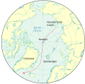
 Worldmap northern.svg 553 × 553; 589 KB

.svg)
.svg)


_(14595870127).jpg)


.jpg)
.jpg)


