Category:Cemetery, Beers, North Brabant
Jump to navigation
Jump to search
| Object location | | View all coordinates using: OpenStreetMap |
|---|
cemetery in Beers, the Netherlands  | |||||
| Upload media | |||||
| Instance of | |||||
|---|---|---|---|---|---|
| Location | Beers, Beers | ||||
| Street address |
| ||||
| Located on street |
| ||||
| Has part(s) | |||||
| Heritage designation |
| ||||
 | |||||
|
This is a category about rijksmonumentcomplex number 517499
|
Kerk van de H. Lambertus
|
This is a category about rijksmonument number 517500
|
Vijf grafkruisen
|
This is a category about rijksmonument number 517501
|
Grafmonument met Pietàbeeld
|
This is a category about rijksmonument number 521389
|
Grafkruis van J.A. Barten
|
This is a category about rijksmonument number 521390
|
Grafkruis van P. Barten
|
This is a category about rijksmonument number 521391
|
Grafkruis van P.H. Barten
|
This is a category about rijksmonument number 521392
|
Grafkruis van M. Barten
|
This is a category about rijksmonument number 521393
|
Grafkruis van P. Barten
|
This is a category about rijksmonument number 521394
|
Grafkruis van H. Barten
|
This is a category about rijksmonument number 521395
|
Grafkruis van A.M. Barten
|
This is a category about rijksmonument number 521396
|
| Address |
|
Subcategories
This category has only the following subcategory.
G
- Graves family de Quay, Beers (10 F)
Media in category "Cemetery, Beers, North Brabant"
The following 16 files are in this category, out of 16 total.
-
 Beers (N.-Br.) beeldengroep op kerkhof.JPG 3,648 × 2,736; 4.19 MB
-
 Beers - Calvariegroep bij de Sint Lambertuskerk.jpg 3,000 × 4,000; 2.51 MB
-
 Beers - Christusbeeld op het kerkhof bij de Sint Lambertuskerk.jpg 4,000 × 3,000; 4.06 MB
-
 Beers kerk monument.png 671 × 599; 710 KB
-
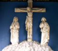
 Beers Rijksmonument 517500 graf pastoor Bertens met calvariegroep.JPG 2,736 × 3,648; 3.21 MB
-
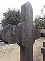
 Beers Rijksmonument 517501 4 van 5 grote grafkruisen fam. Barten.JPG 3,648 × 2,736; 3.46 MB
-
 Beers Rijksmonument 517501 grafkruis Theodora Barten.JPG 2,736 × 3,648; 3.53 MB
-
 Beers Rijksmonument 517501 vijf grote grafkruisen fam. Barten.jpg 3,068 × 2,045; 965 KB
-
 Beers Rijksmonument 517501, 521393 grafkruis Mechelina Barten.JPG 2,736 × 3,648; 3.48 MB
-
 Beers Rijksmonument 517501, 521394 grafkruis Peternella Barten.JPG 2,736 × 3,648; 3.5 MB
-
 Beers Rijksmonument 517501, 521395 grafkruis Hermina Barten.JPG 2,736 × 3,648; 3.48 MB
-
 Beers Rijksmonument 517501, 521396 grafkruis Anna Maria Barten.JPG 2,736 × 3,648; 3.5 MB
-
 Beers Rijksmonument 521389 Graf Burgemeester Thijssen met pietabeeld..JPG 2,736 × 3,648; 3.48 MB
-
 Beers Rijksmonument 521390 Johanna Agatha Barten.JPG 3,648 × 2,736; 3.52 MB
-
 Beers Rijksmonument 521391 grafkruis Petrus Barten.JPG 2,736 × 3,648; 3.36 MB
-
 Beers Rijksmonument 521392 grafkruis Petrus Henricus Barten.JPG 2,736 × 3,648; 3.52 MB
_beeldengroep_op_kerkhof.JPG)


