Category:Berghuisje (Maarn)
Jump to navigation
Jump to search
| Object location | | View all coordinates using: OpenStreetMap |
|---|
 | |||||
| Upload media | |||||
| Instance of | |||||
|---|---|---|---|---|---|
| Location |
| ||||
| Has part(s) | |||||
| Heritage designation |
| ||||
 | |||||
|
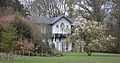
This is a category about rijksmonumentcomplex number 526386
|
Hoofdgebouw:
|
This is a category about rijksmonument number 526387
|
Historische tuin- en parkaanleg:
|
This is a category about rijksmonument number 526388
|
Garage:
|
This is a category about rijksmonument number 526389
|
Schuur:
|
This is a category about rijksmonument number 526390
|
Koepel van stoop:
|
This is a category about rijksmonument number 526393
|
| Address |
|
Media in category "Berghuisje (Maarn)"
The following 4 files are in this category, out of 4 total.
-
 Berghuis.jpg 3,264 × 2,448; 2.26 MB
-
 Maarn - Berghuisje, De Laagt 8 RM526387.JPG 4,608 × 2,400; 1.55 MB
-
 Maarn - Schuur, De Laagt 2 RM526390.JPG 3,708 × 2,680; 1.41 MB
-
 Maarn - Weide en tuin voor Berghuisje, De Laagt 8 RM526388.JPG 4,389 × 3,246; 3.28 MB


