Category:Amstel 230, Amsterdam
Jump to navigation
Jump to search
| Object location | | View all coordinates using: OpenStreetMap |
|---|
 | |||||
| Upload media | |||||
| Instance of |
| ||||
|---|---|---|---|---|---|
| Location | Amsterdam, North Holland, Netherlands | ||||
| Street address |
| ||||
| Located on street | |||||
| Heritage designation |
| ||||
 | |||||
|
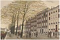
This is a category about rijksmonument number 236
|
| Address |
|
Media in category "Amstel 230, Amsterdam"
The following 4 files are in this category, out of 4 total.
-
 Amsterdam - Amstel 230.JPG 2,736 × 3,648; 4.71 MB
-
 J.M.A. Rieke Afb KOG-AA-2-07-161.jpg 4,888 × 3,293; 2.71 MB
-
 Overzicht - Amsterdam - 20015674 - RCE.jpg 1,200 × 888; 239 KB
-
 Overzicht voorgevels - Amsterdam - 20370971 - RCE.jpg 1,200 × 1,192; 239 KB


