Category:Çamlıhemşin
Jump to navigation
Jump to search
district and town in Rize Province, Turkey   | |||||
| Upload media | |||||
| Instance of | |||||
|---|---|---|---|---|---|
| Location | Rize Province, Turkey | ||||
| Population |
| ||||
 | |||||
Subcategories
This category has the following 14 subcategories, out of 14 total.
A
- Ayder (1 P, 100 F)
E
- Elevit Yaylası (1 P, 7 F)
F
- Fırtına River bridges (5 F)
G
- Gelintülü Waterfall (3 F)
K
M
- Mehmet Necati Memişoğlu (1 F)
P
- Palovit Waterfall (18 F)
- Pokut Yaylası (20 F)
T
- Tar Deresi Bulut Waterfall (4 F)
Y
- Yaylaköy, Çamlıhemşin (2 F)
- Yukarışimşirli (4 F)
Z
- Zilkale (19 F)
- Ziya Hurşit Bey (7 F)
Ç
- Çat, Çamlıhemşin (4 F)
Media in category "Çamlıhemşin"
The following 90 files are in this category, out of 90 total.
-
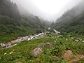
 A valley in Çamlıhemşin.jpg 4,928 × 3,264; 1.36 MB
-
 Amlakit.jpg 1,080 × 791; 234 KB
-
 Asagikackar008.jpg 1,024 × 768; 178 KB
-
 Asagikackar016.jpg 1,024 × 768; 120 KB
-
 Avusor golu.jpg 4,256 × 2,756; 10.98 MB
-
 Aşağı Ceymakçur 01.jpg 3,024 × 4,032; 3.87 MB
-
 Aşağı Ceymakçur 02.jpg 3,024 × 4,032; 3.31 MB
-
 Aşağı Ceymakçur 03.jpg 4,032 × 3,024; 3.78 MB
-
 Aşağı Ceymakçur 04.jpg 3,024 × 4,032; 2.96 MB
-
 Aşağı Ceymakçur 05.jpg 4,032 × 3,024; 2.26 MB
-
 Aşağı Ceymakçur 06.jpg 4,032 × 3,024; 1.26 MB
-
 Aşağı Ceymakçur 07.jpg 4,032 × 3,024; 1.53 MB
-
 Aşağı Ceymakçur-Yukarı Ceymakçur Route 01.jpg 3,024 × 4,032; 3.69 MB
-
 Aşağı Ceymakçur-Yukarı Ceymakçur Route 02.jpg 4,032 × 3,024; 3.9 MB
-
 Aşağı Ceymakçur-Yukarı Ceymakçur Route 03.jpg 3,024 × 4,032; 3.31 MB
-
 Aşağı Ceymakçur-Yukarı Ceymakçur Route 04.jpg 3,024 × 4,032; 4.98 MB
-
 Aşağı Ceymakçur-Yukarı Ceymakçur Route 05.jpg 3,024 × 4,032; 4.43 MB
-
 Bulut.tif 3,872 × 2,315; 17.75 MB
-
 Bungalow in Rize.jpg 3,975 × 3,180; 1.22 MB
-
 Camlihemsin Cinciva.jpg 3,168 × 4,752; 4.45 MB
-
 Dağ ve Orman... - panoramio.jpg 4,608 × 3,456; 5.27 MB
-
 DSC 4550azak.jpg 4,928 × 3,264; 9.04 MB
-
 Dumanlı Dağlar... - panoramio.jpg 4,608 × 3,456; 4.95 MB
-
 Fırtına Vadisi Şimşir Ormanları.jpg 1,024 × 683; 1.26 MB
-
 Foggy Lake - panoramio.jpg 3,072 × 2,304; 2.89 MB
-
 Foggy View Camlihemsin.jpg 4,752 × 3,168; 3.95 MB
-
 Green Valley - panoramio - Tadeáš Gregor.jpg 3,072 × 2,304; 3.45 MB
-
 Güneş ve Sis... - panoramio.jpg 4,608 × 3,456; 6.05 MB
-
 Houseskackar.jpg 3,096 × 3,870; 1.34 MB
-
 IMG- hayatımızın yansıması.jpg 1,440 × 1,535; 132 KB
-
 IMG-sis ve doğa.jpg 2,016 × 1,512; 160 KB
-
 Kackardaisy.jpg 3,096 × 4,128; 4.26 MB
-
 Kavrun Yaylası.jpg 1,024 × 776; 517 KB
-
 Kaçkar Yaylası panaromik.jpg 2,181 × 711; 328 KB
-
 Kaçkar Yaylası panaromik2.jpg 3,384 × 574; 397 KB
-
 Merkez, Ortanköy Köyü Yolu, 53790 Çamlıhemşin Rize.jpg 3,024 × 3,780; 4.83 MB
-
 Mikron Bridge (მიკრონიშ ხინჯი), Çamlıhemşin (ვიჯა, Vija), Lazistan - Lazeti.jpg 5,184 × 3,456; 10.9 MB
-
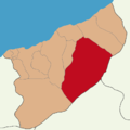 Rize location Çamlıhemşin.png 800 × 800; 38 KB
-
 Sal Yaylası.jpg 4,000 × 3,000; 1.93 MB
-
 Sis Açarken... - panoramio.jpg 4,608 × 3,456; 5.05 MB
-
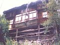
 Tobira'daki eski bir konak.jpg 1,932 × 2,576; 1.95 MB
-

-
 Turkish Flag Camlihemsin.jpg 4,752 × 3,168; 4.03 MB
-
 Yeşilin Her Tonu... - panoramio.jpg 4,608 × 3,456; 6.34 MB
-
 Yol Manzarası... - panoramio.jpg 4,608 × 3,456; 6.05 MB
-
 Yukarı Ceymakçur 01.jpg 4,032 × 3,024; 1.51 MB
-
 Yukarı Ceymakçur 02.jpg 4,032 × 3,024; 2.22 MB
-
 Yukarı Ceymakçur 03.jpg 3,024 × 4,032; 2.04 MB
-
 Yukarı Ceymakçur 04.jpg 3,024 × 4,032; 3.58 MB
-
 Yukarı Kavrun... - panoramio.jpg 4,608 × 3,456; 5.65 MB
-
 Yukarikackar026.jpg 1,024 × 768; 202 KB
-
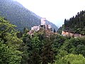 Zil Kalesi 21 05 2010 Burg.jpg 3,628 × 2,720; 2.98 MB
-
 Zirve Yolunda... - panoramio.jpg 4,608 × 3,456; 6.54 MB
-
 Çamilhemsin (5095714083).jpg 1,545 × 1,024; 566 KB
-
 Çamilhemsin (5095716889).jpg 1,545 × 1,024; 842 KB
-
 Çamilhemsin (5095718001).jpg 1,545 × 1,024; 540 KB
-
 Çamilhemsin (5096311816).jpg 1,545 × 1,024; 679 KB
-
 Çamilhemsin (5096313458).jpg 1,545 × 1,024; 793 KB
-
 Çamilhemsin Jawa Motorcycle (5095717311).jpg 1,545 × 1,024; 657 KB
-
 Çamilhemsin Precarious Communication (5096316048).jpg 1,024 × 1,545; 843 KB
-
 Çamlıhemşin (5019244491).jpg 2,560 × 1,920; 945 KB
-
 Çamlıhemşin (5019245109).jpg 2,560 × 1,920; 1,016 KB
-
 Çamlıhemşin -- Muhlama (5019844858).jpg 2,560 × 1,920; 962 KB
-
 Çamlıhemşin Bag Pipe Maker's Workshop (5019853156).jpg 2,560 × 1,920; 1 MB
-
 Çamlıhemşin Hipsters in Turkish Mountains (5019852610).jpg 2,560 × 1,920; 1,017 KB
-
 Çamlıhemşin Historical Stone Bridge and Stream.jpg 5,648 × 3,764; 16.07 MB
-
 Çamlıhemşin Historical Stone Bridge.jpg 5,760 × 3,840; 21.74 MB
-
 Çamlıhemşin Java (5019852032).jpg 2,560 × 1,920; 973 KB
-
 Çamlıhemşin Kaçkar 01.jpg 5,184 × 3,456; 3.85 MB
-
 Çamlıhemşin Kaçkar 02.jpg 5,184 × 3,456; 4.35 MB
-
 Çamlıhemşin Kaçkar 03.jpg 5,184 × 3,456; 3.59 MB
-
 Çamlıhemşin Kaçkar 04.jpg 5,184 × 3,456; 4.52 MB
-
 Çamlıhemşin Kaçkar.jpg 3,637 × 2,433; 5.29 MB
-
 Çamlıhemşin Muhlama (5019240591).jpg 2,560 × 1,920; 947 KB
-
 Çamlıhemşin Muhlama (5019241285).jpg 2,560 × 1,920; 923 KB
-
 Çamlıhemşin Sal Plateau and Clouds.jpg 5,760 × 3,546; 13.74 MB
-
 Çamlıhemşin Sal Plateau.jpg 5,625 × 3,351; 13.93 MB
-
 Çamlıhemşin Signal, signal? (5019246315).jpg 2,560 × 1,920; 953 KB
-
 Çamlıhemşin Tea Tree Trimmer (5019243919).jpg 2,560 × 1,920; 1.03 MB
-
 Çamlıhemşin-ev.jpg 640 × 480; 134 KB
-
 ÇAMLIHEMŞİN 2010 - panoramio.jpg 3,648 × 2,736; 2.42 MB
-
 ÇAMLIHEMŞİN TEMMUZ 2010 - panoramio (2).jpg 3,648 × 2,736; 2.47 MB
-
 ÇAMLIHEMŞİN TEMMUZ 2010 - panoramio (4).jpg 3,648 × 2,736; 2.48 MB
-
 ÇAMLIHEMŞİN TEMMUZ 2010 - panoramio.jpg 3,648 × 2,736; 2.35 MB
-
 ÇAMLIHEMŞİN-FIRTINA DERESİ - panoramio.jpg 3,648 × 2,736; 2.44 MB
-
 ÇAMLIHEMŞİN-FIRTINA DERESİ TEMMUZ 2010 - panoramio (1).jpg 3,648 × 2,736; 2.43 MB
-
 ÇAMLIHEMŞİN-FIRTINA DERESİ TEMMUZ 2010 - panoramio.jpg 3,648 × 2,736; 2.48 MB
-
 Çinaçor göller - panoramio.jpg 3,072 × 2,304; 2.75 MB
-
 Çinçiva.jpg 3,872 × 2,592; 7.52 MB
-
 فندق ومطعم ايليزان ايدير . تركيا - panoramio.jpg 2,448 × 2,448; 2.47 MB


,_%C3%87aml%C4%B1hem%C5%9Fin_(%E1%83%95%E1%83%98%E1%83%AF%E1%83%90,_Vija),_Lazistan_-_Lazeti.jpg)


.jpg)
.jpg)
.jpg)
.jpg)
.jpg)
.jpg)
.jpg)
.jpg)
.jpg)
.jpg)
.jpg)
.jpg)


.jpg)


.jpg)
.jpg)


.jpg)
.jpg)


.jpg)
.jpg)


.jpg)


