File:Wien - Albrechtsbrunnen.JPG
Jump to navigation
Jump to search

Size of this preview: 800 × 557 pixels. Other resolutions: 320 × 223 pixels | 640 × 445 pixels | 1,024 × 713 pixels | 1,280 × 891 pixels | 2,560 × 1,782 pixels | 4,160 × 2,895 pixels.
Original file (4,160 × 2,895 pixels, file size: 9.85 MB, MIME type: image/jpeg)
Captions
Captions
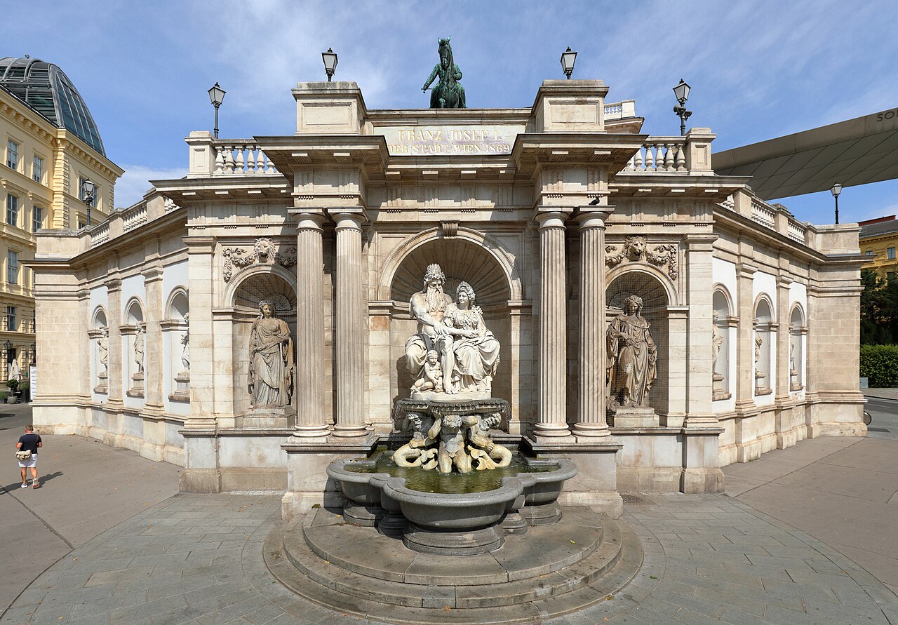
The Albrechtsbrunnen, also known as Danubiusbrunnen, a fountain in the 1st district of Vienna.
Summary
[edit]
| Description |
Deutsch: Der Albrechtsbrunnen bzw. Danubiusbrunnen im 1. Wiener Gemeindebezirk Innere Stadt.
Ab 24. Juli 1864 wurde unterhalb des Vorplatzes der Albertina eine monumentale Brunnenanlage errichtet und am 24. Dezember 1869 enthüllt. Die Architektur des als Wandbrunnen errichteten Albrechtsbrunnens stammt von Moritz von Löhr, die Allegorien schuf Johann Meixner aus weißem Carraramarmor. Die beiden Hauptfiguren stellen Danubius und Vindobona dar und die Seitenfiguren sind Allegorien von österr. Flüssen: [1]. Ursprünglich gab es zwei weitere Seitenfiguren, wobei eine jedoch wegen des Baus einer Rolltreppe für die Albertina weichen musste und um die Symmetrie der Brunnenanlage zu wahren, wurde auch die gegenüberliegende entfernt. English: The Albrechtsbrunnen, also known as Danubiusbrunnen, a fountain in the 1st district of Vienna. |
| Date | |
| Source | Own work |
| Author | C.Stadler/Bwag |
| Permission (Reusing this file) |
Deutsch: Hallo, du darfst mein Foto kostenlos nutzen, aber nenne mich bitte als Fotograf, beispielsweise „Foto: C.Stadler/Bwag“ oder © C.Stadler/Bwag; CC-BY-SA-4.0. Auf mehr Angaben bestehe ich nicht - im Gegensatz zu manch anderen, die die Vorgaben der unten angeführten Lizenzierung auf Punkt und Beistrich einfordern. English: Feel free to use my photos, but please mention me as the author like © C.Stadler/Bwag or © C.Stadler/Bwag; CC-BY-SA-4.0 (that's good enough) and if you want send me a message: bwag@gmx.net. |
| Object location | | View this and other nearby images on: OpenStreetMap |
|---|
| Camera location | | View this and other nearby images on: OpenStreetMap |
|---|
Licensing
[edit]
I, the copyright holder of this work, hereby publish it under the following license:
This file is licensed under the Creative Commons Attribution-Share Alike 4.0 International license.
- You are free:
- to share – to copy, distribute and transmit the work
- to remix – to adapt the work
- Under the following conditions:
- attribution – You must give appropriate credit, provide a link to the license, and indicate if changes were made. You may do so in any reasonable manner, but not in any way that suggests the licensor endorses you or your use.
- share alike – If you remix, transform, or build upon the material, you must distribute your contributions under the same or compatible license as the original.
File history
Click on a date/time to view the file as it appeared at that time.
| Date/Time | Thumbnail | Dimensions | User | Comment | |
|---|---|---|---|---|---|
| current | 14:29, 16 August 2021 | | 4,160 × 2,895 (9.85 MB) | Bwag (talk | contribs) | {{Information |Description= {{de|1= Der Albrechtsbrunnen bzw. Danubiusbrunnen im 1. Wiener Gemeindebezirk Innere Stadt.<br/>Ab 24. Juli 1864 wurde unterhalb des Vorplatzes der Albertina eine monumentale Brunnenanlage errichtet und am 24. Dezember 1869 enthüllt. Die Architektur des als Wandbrunnen errichteten Albrechtsbrunnens stammt von Moritz von Löhr, die Allegorien schuf Johann Meixner aus weißem Carraramarmor. Die beiden Hauptfiguren stellen Danubius und Vindobona dar und die Seitenfigur... |
You cannot overwrite this file.
File usage on Commons
The following 2 pages use this file:
File usage on other wikis
The following other wikis use this file:
- Usage on an.wikipedia.org
- Usage on de.wikipedia.org
- Usage on fr.wikipedia.org
- Usage on hu.wikipedia.org
- Usage on www.wikidata.org