File:Venezuela en 1810.jpg
Jump to navigation
Jump to search
Size of this preview: 800 × 554 pixels. Other resolutions: 320 × 222 pixels | 640 × 443 pixels | 1,024 × 709 pixels | 1,280 × 887 pixels | 1,539 × 1,066 pixels.
Original file (1,539 × 1,066 pixels, file size: 683 KB, MIME type: image/jpeg)
Captions
Captions
Add a one-line explanation of what this file represents
Summary
[edit]| Description |
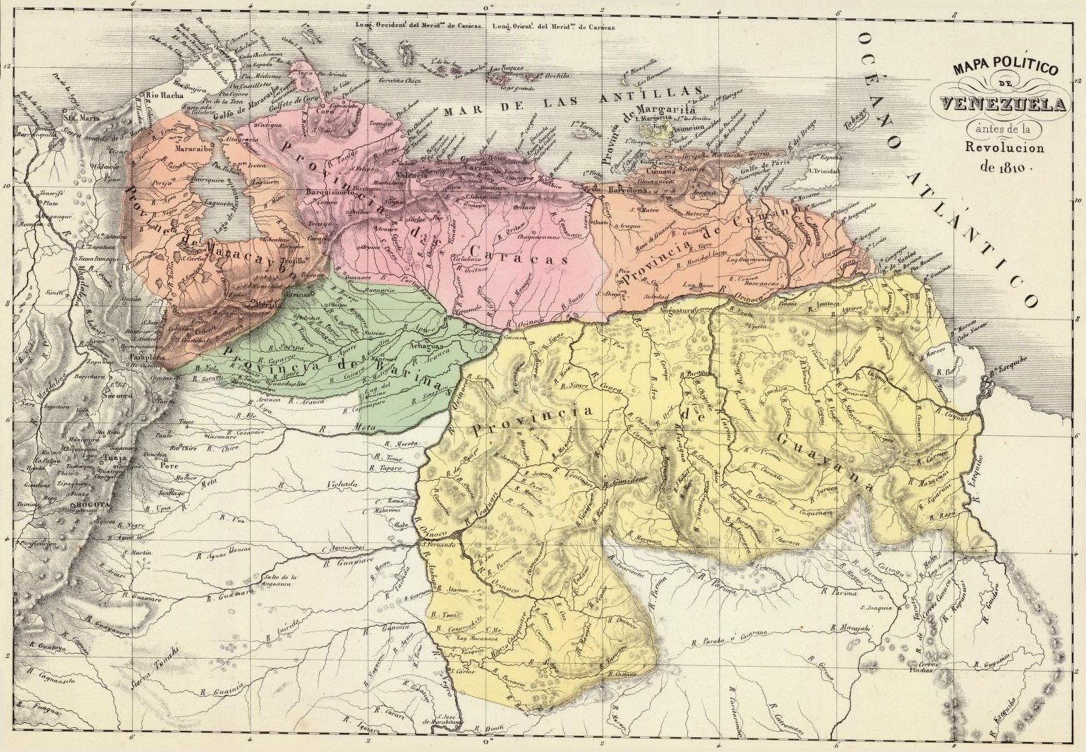
Español: Mapa político de Venezuela en 1810. Tomado del "Atlas físico y político de la República de Venezuela", 1840. English: Political map of Venezuela in 1810. Taken from the "Physical and Political Atlas of the Republic of Venezuela", by Agustín Codazzi, 1840. Português: Mapa político da Venezuela em 1810. Extraído do "Atlas físico y político da República da Venezuela", pelo Agustín Codazzi, 1840. Français : Carte politique du Venezuela en 1810. Extrait de l'Atlas physique et politique de la République du Venezuela, par Agustín Codazzi, 1840. Nederlands: Politieke kaart van Venezuela in 1810. Genomen uit de fysieke en politieke atlas van de Republiek Venezuela, door Agustín Codazzi, 1840. |
||||||||||||||||||||
| Date | |||||||||||||||||||||
| Source | Historical Maps by Agustín Codazzi, from David Rumsey Website | ||||||||||||||||||||
| Author |
|
||||||||||||||||||||

Licensing
[edit]
|
This work is in the public domain in its country of origin and other countries and areas where the copyright term is the author's life plus 100 years or fewer. | |
| This file has been identified as being free of known restrictions under copyright law, including all related and neighboring rights. | |
File history
Click on a date/time to view the file as it appeared at that time.
| Date/Time | Thumbnail | Dimensions | User | Comment | |
|---|---|---|---|---|---|
| current | 19:38, 7 September 2008 | | 1,539 × 1,066 (683 KB) | Milenioscuro (talk | contribs) | {{Information |Description= |Source= |Date= |Author= |Permission= |other_versions= }} |
| 12:34, 15 December 2007 |  | 616 × 427 (79 KB) | Milenioscuro (talk | contribs) | {{Information |Description=Venezuela en 1810 |Source=David Rumsey website |Date=1810 |Author=Agustin Codazzi |Permission= |other_versions= }} |
You cannot overwrite this file.
File usage on Commons
The following 3 pages use this file:
File usage on other wikis
The following other wikis use this file:
- Usage on ar.wikipedia.org
- Usage on ca.wikipedia.org
- Usage on da.wikipedia.org
- Usage on de.wikipedia.org
- Usage on en.wikipedia.org
- Usage on es.wikipedia.org
- Geografía de Venezuela
- Organización territorial de Venezuela
- Independencia de Venezuela
- Guayana Esequiba
- Virreinato de Nueva Granada
- Tercera República de Venezuela
- Provincia de Guayana
- Época de la colonia (Venezuela)
- Real Audiencia de Caracas
- Provincia de Venezuela
- Intendencia de Caracas
- Campaña de Guayana
- Discusión:Historia territorial de Colombia/Archivo1
- Organización territorial del Virreinato de Nueva Granada
- Frontera entre Colombia y Venezuela
- Segunda Batalla de Angostura
- Río Tupuru
- Usage on eu.wikipedia.org
- Usage on fr.wikipedia.org
- Usage on gl.wikipedia.org
- Usage on hr.wikipedia.org
- Usage on id.wikipedia.org
- Usage on it.wikipedia.org
- Usage on lt.wikipedia.org
- Usage on mt.wikipedia.org
- Usage on no.wikipedia.org
- Usage on pt.wikipedia.org
- Usage on ro.wikipedia.org
- Usage on ru.wikipedia.org
- Usage on sh.wikipedia.org
- Usage on sv.wikipedia.org
- Usage on tr.wikipedia.org
View more global usage of this file.