File:Official United Nations World Map - 20 February 2020.svg

Original file (SVG file, nominally 1,457 × 741 pixels, file size: 3.12 MB)
Captions
Captions
Summary
[edit]| Description |
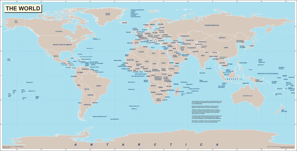
English: World map produced by the United Nations Geospatial Information Section (GIS, formerly Cartographic Section) and released on 20 February 2020.
Français : Carte du monde produite par la Section d'information géospatiale des Nations Unies (SIG, anciennement Section cartographique) et publiée le 20 Février 2020. |
|||
| Date | ||||
| Source |
English: World map from the United Nations Geospatial Information Section website. Map No. 4170 Rev. 18.1 UNITED NATIONS
February 2020 |
|||
| Author | United Nations | |||
| Permission (Reusing this file) |
|
|||
| Other versions |
|

.svg)
File history
Click on a date/time to view the file as it appeared at that time.
| Date/Time | Thumbnail | Dimensions | User | Comment | |
|---|---|---|---|---|---|
| current | 06:56, 6 July 2020 | | 1,457 × 741 (3.12 MB) | Yash400 (talk | contribs) | Converting everything to path, so that text scales properly. |
| 14:13, 3 July 2020 |  | 1,457 × 741 (1.49 MB) | Chipmunkdavis (talk | contribs) | Plain svg | |
| 11:50, 3 July 2020 |  | 1,457 × 741 (1.71 MB) | Yash400 (talk | contribs) | Uploaded own work with UploadWizard |
You cannot overwrite this file.
File usage on Commons
The following 2 pages use this file:
File usage on other wikis
The following other wikis use this file:
- Usage on en.wikipedia.org
- Usage on en.wiktionary.org
- Usage on zh.wiktionary.org