File:Maps-sodor-railways-amoswolfe.svg
Jump to navigation
Jump to search

Size of this PNG preview of this SVG file: 800 × 589 pixels. Other resolutions: 320 × 236 pixels | 640 × 471 pixels | 1,024 × 754 pixels | 1,280 × 942 pixels | 2,560 × 1,884 pixels | 803 × 591 pixels.
Original file (SVG file, nominally 803 × 591 pixels, file size: 626 KB)
Captions
Captions
Add a one-line explanation of what this file represents
| Description | |
| Date | |
| Source | Self-made and uploaded by author |
| Author | AmosWolfe |
| Other versions | Originally uploaded as PNG as Image:Maps-sodor-railways-amoswolfe.png |
This file is licensed under the Creative Commons Attribution-Share Alike 2.5 Generic license.
- You are free:
- to share – to copy, distribute and transmit the work
- to remix – to adapt the work
- Under the following conditions:
- attribution – You must give appropriate credit, provide a link to the license, and indicate if changes were made. You may do so in any reasonable manner, but not in any way that suggests the licensor endorses you or your use.
- share alike – If you remix, transform, or build upon the material, you must distribute your contributions under the same or compatible license as the original.
File history
Click on a date/time to view the file as it appeared at that time.
| Date/Time | Thumbnail | Dimensions | User | Comment | |
|---|---|---|---|---|---|
| current | 07:27, 14 March 2017 | | 803 × 591 (626 KB) | Sebastian Wallroth (talk | contribs) | 256 polygons --> 1 gradient |
| 07:04, 14 March 2017 |  | 803 × 591 (4.01 MB) | Sebastian Wallroth (talk | contribs) | cropped | |
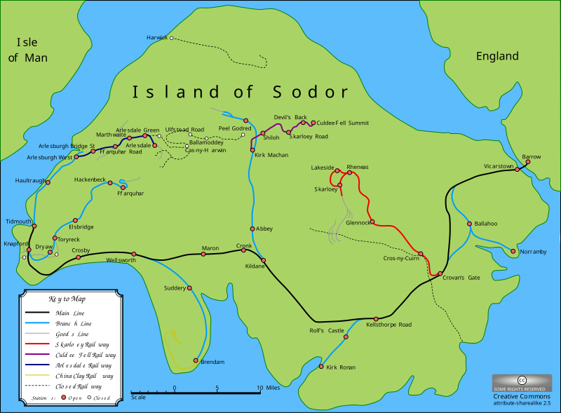
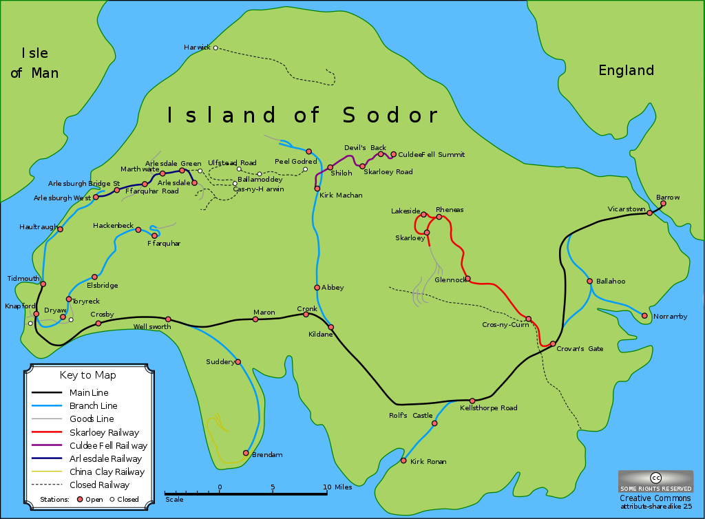
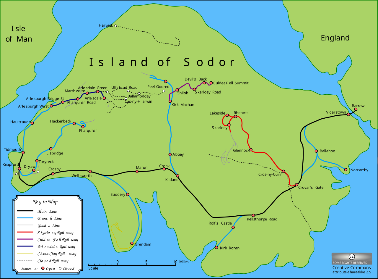
| 00:26, 4 September 2007 |  | 842 × 595 (4.03 MB) | AmosWolfe (talk | contribs) | {{Information |Description= A map of the Island of Sodor from The Railway Series by Rev. W. Awdry. |Source= Self-made and uploaded by author |Date= 11th September 2005 |Author= [[Use |
You cannot overwrite this file.
File usage on Commons
The following 7 pages use this file:
File usage on other wikis
The following other wikis use this file:
- Usage on ast.wikipedia.org
- Usage on cs.wikipedia.org
- Usage on el.wikipedia.org
- Usage on en.wikipedia.org
- Usage on en.wikivoyage.org
- Usage on es.wikipedia.org
- Usage on fa.wikipedia.org
- Usage on fi.wikipedia.org
- Usage on fr.wikipedia.org
- Usage on he.wikipedia.org
- Usage on hu.wikipedia.org
- Usage on id.wikipedia.org
- Usage on it.wikipedia.org
- Usage on ja.wikipedia.org
- Usage on kw.wikipedia.org
- Usage on nl.wikipedia.org
- Usage on no.wikipedia.org
- Usage on pt.wikipedia.org
- Usage on ru.wikipedia.org
- Usage on simple.wikipedia.org
- Usage on th.wikipedia.org
- Usage on tr.wikipedia.org
- Usage on www.wikidata.org