File:Map of Solomons area in 1942.png
Jump to navigation
Jump to search
Size of this preview: 800 × 432 pixels. Other resolutions: 320 × 173 pixels | 640 × 346 pixels | 1,200 × 648 pixels.
Original file (1,200 × 648 pixels, file size: 341 KB, MIME type: image/png)
Captions
Captions
Add a one-line explanation of what this file represents
Summary
[edit]| Description |
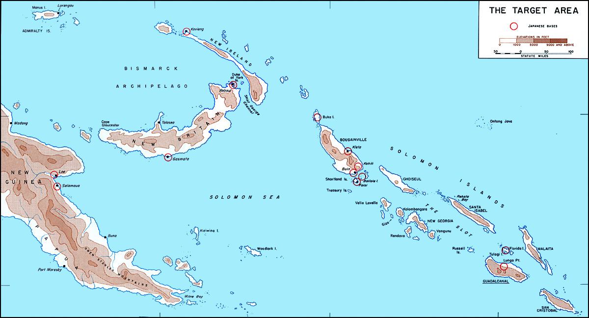
English: Map of Solomons area in 1942 before invasion of Guadalcanal showing Japanese bases circled in red. Image fixed by Angelus (talk).
Italiano: Cartina delle Isole Salomone nel 1942, prima dell'invasione di Guadalcanal. Le basi giapponesi sono cerchiate in rosso. Immagine corretta da Angelus (talk). |
||||||
| Source | www.ibiblio.org | ||||||
| Author | derivative version: Angelus | ||||||
| Permission (Reusing this file) |
|
||||||

File history
Click on a date/time to view the file as it appeared at that time.
| Date/Time | Thumbnail | Dimensions | User | Comment | |
|---|---|---|---|---|---|
| current | 16:44, 26 May 2011 | | 1,200 × 648 (341 KB) | ANGELUS (talk | contribs) | == {{int:filedesc}} == {{Information |Description= {{en|Map of Solomons area in 1942 before invasion of Guadalcanal showing Japanese bases circled in red. Modified by ~~~.}} {{it|Cartina delle [[w:it:Isole Sal |
You cannot overwrite this file.
File usage on Commons
The following 2 pages use this file:
File usage on other wikis
The following other wikis use this file:
- Usage on ast.wikipedia.org
- Usage on da.wikipedia.org
- Usage on en.wikipedia.org
- Usage on eo.wikipedia.org
- Usage on es.wikipedia.org
- Usage on eu.wikipedia.org
- Usage on fr.wikipedia.org
- Usage on he.wikipedia.org
- Usage on id.wikipedia.org
- Usage on it.wikipedia.org
- Usage on ro.wikipedia.org
- Usage on ru.wikipedia.org
- Usage on zh.wikipedia.org