File:Location of Dien Bien within Vietnam.png
Jump to navigation
Jump to search
No higher resolution available.
Location_of_Dien_Bien_within_Vietnam.png (200 × 333 pixels, file size: 33 KB, MIME type: image/png)
Captions
Captions
Add a one-line explanation of what this file represents

|
This locator map image could be re-created using vector graphics as an SVG file. This has several advantages; see Commons:Media for cleanup for more information. If an SVG form of this image is available, please upload it and afterwards replace this template with
{{vector version available|new image name}}.
It is recommended to name the SVG file “Location of Dien Bien within Vietnam.svg”—then the template Vector version available (or Vva) does not need the new image name parameter. |
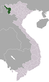
Map locating Dien Bien province in Vietnam. Made for Wikipedia by uploader.

|
Permission is granted to copy, distribute and/or modify this document under the terms of the GNU Free Documentation License, Version 1.2 or any later version published by the Free Software Foundation; with no Invariant Sections, no Front-Cover Texts, and no Back-Cover Texts. A copy of the license is included in the section entitled GNU Free Documentation License. |
| This file is licensed under the Creative Commons Attribution-Share Alike 3.0 Unported license. | ||
| ||
| This licensing tag was added to this file as part of the GFDL licensing update. |
File history
Click on a date/time to view the file as it appeared at that time.
| Date/Time | Thumbnail | Dimensions | User | Comment | |
|---|---|---|---|---|---|
| current | 22:09, 20 January 2006 | | 200 × 333 (33 KB) | Vardion (talk | contribs) | correcting boundary between Dien Bien and Lai Chau provinces |
| 05:17, 14 June 2005 |  | 200 × 333 (33 KB) | Vardion (talk | contribs) | Map locating Dien Bien province in Vietnam. Made for Wikipedia by uploader. {{GFDL}} |
You cannot overwrite this file.
File usage on Commons
The following 7 pages use this file:
File usage on other wikis
The following other wikis use this file:
- Usage on ar.wikipedia.org
- Usage on bg.wikipedia.org
- Usage on br.wikipedia.org
- Usage on ca.wikipedia.org
- Usage on de.wikivoyage.org
- Usage on diq.wikipedia.org
- Usage on en.wikipedia.org
- Operation Castor
- Mường Chà district
- Tuần Giáo district
- Template:DienBien-geo-stub
- Điện Biên district
- Điện Biên Đông
- Mường Chà
- Mường Nhé
- Tủa Chùa
- Tuần Giáo
- Talk:Battle of Dien Bien Phu/Archive 2
- Category:Populated places in Điện Biên province
- Keo Lôm
- Chiềng Sơ
- Háng Lìa
- Luân Giói
- Na Son
- Nong U
- Phì Nhừ
- Phình Giàng
- Pú Hồng
- Pu Nhi
- Tìa Dình
- Xa Dung
- Mường Lói
- Mường Luân
- Mường Nhà
- Mường Phăng
- Mường Pồn
- Nà Nhạn
- Nà Tấu
- Na Ư
- Noọng Hẹt
- Noong Luống
- Núa Ngam
- Pa Thơm
- Sam Mứn
- Thanh An, Điện Biên
- Thanh Chăn
- Thanh Hưng
- Thanh Luông
- Thanh Nưa
View more global usage of this file.