File:Karta över de europeiska delarna av Sovjetunionen på 1920-talet.jpg
Jump to navigation
Jump to search

Size of this preview: 439 × 600 pixels. Other resolutions: 176 × 240 pixels | 351 × 480 pixels | 562 × 768 pixels | 750 × 1,024 pixels | 2,548 × 3,480 pixels.
Original file (2,548 × 3,480 pixels, file size: 1.81 MB, MIME type: image/jpeg)
Captions
Captions
Add a one-line explanation of what this file represents
Summary
[edit]| Description |
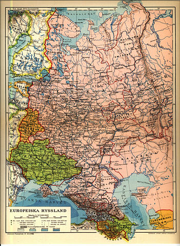
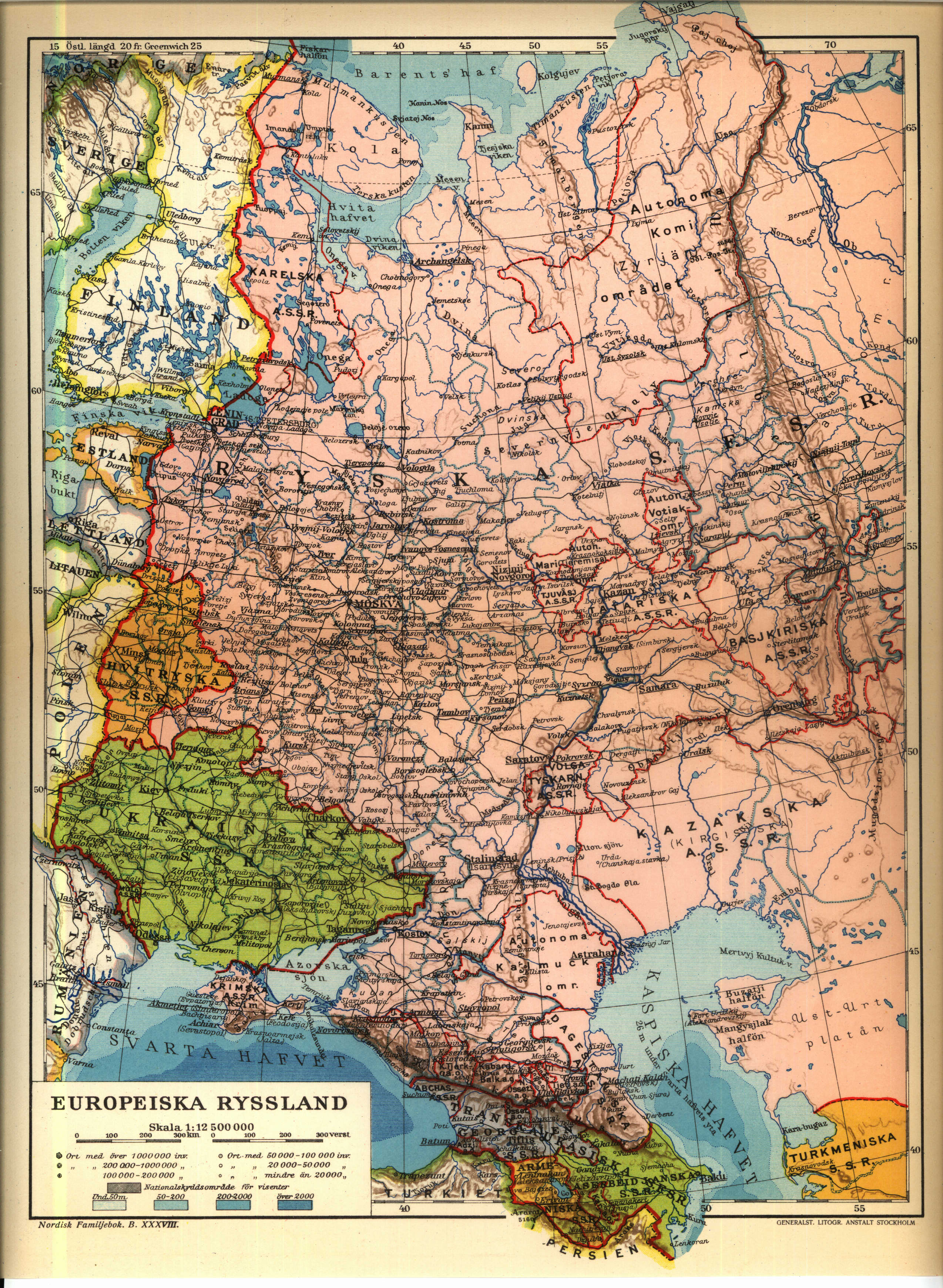
English: 1926 Map of the western Soviet Union region.
Norsk bokmål: från Nordisk familjebok |
||||||||
| Source | https://runeberg.org/nfcr/ryssland.jpg | ||||||||
| Author | User Den fjättrade ankan on sv.wikipedia | ||||||||
| Permission (Reusing this file) |
|
||||||||
| Other versions |
Derivative works of this file: Karta över de europeiska delarna av Sovjetunionen på 1920-talet Georgiska SSR.jpg, Derivative works of this file: Kaninhalvön.jpg Originally from sv.wikipedia; description page is (was) here * 25 juni 2004 kl.01.54 [[:sv:User:Den fjättrade ankan|Den fjättrade ankan]] 2548x3480 (1 899 294 bytes) <span class="comment">(från Nordisk familjebok)</span> |


(Uploaded using CommonsHelper or PushForCommons)
File history
Click on a date/time to view the file as it appeared at that time.
| Date/Time | Thumbnail | Dimensions | User | Comment | |
|---|---|---|---|---|---|
| current | 22:24, 6 July 2006 | | 2,548 × 3,480 (1.81 MB) | Nicke L (talk | contribs) | {{Information| |Description= från Nordisk familjebok sv:Kategori:Kartor från Nordisk familjebok |Source= |Date= |Author=User Den fjättrade ankan on [http://sv.wikipedia.org sv.wikipedia] |Permission={{Ugglanbild} |
You cannot overwrite this file.
File usage on Commons
The following 8 pages use this file:
File usage on other wikis
The following other wikis use this file:
- Usage on be-tarask.wikipedia.org
- Usage on be.wikipedia.org
- Usage on ca.wikipedia.org
- Usage on cs.wikipedia.org
- Usage on de.wikipedia.org
- Usage on en.wikipedia.org
- Usage on fi.wikipedia.org
- Usage on fr.wikipedia.org
- Usage on ru.wikipedia.org
- Usage on sk.wikipedia.org
- Usage on sq.wikipedia.org
- Usage on sr.wikipedia.org
- Usage on tg.wikipedia.org
- Usage on uk.wikipedia.org
Metadata
Categories:
- 1920s maps of the Soviet Union
- 1920s maps of the Caucasus
- Maps of the history of the Caucasus under Soviet rule
- 1920s maps of Ukraine
- Maps of the history of Kalmykia
- Old maps of subdivisions of the Soviet Union
- Maps of the history of the Republic of Karelia
- Maps with a scale of 1:12,500,000
- Maps from Nordisk familjebok