File:Great Lakes region as viewed from the Moderate Resolution Imaging Spectroradiometer on NASA’s Aqua satellite on 28 August 2010 at 1330 Central Daylight Time.png
Jump to navigation
Jump to search

Size of this preview: 780 × 600 pixels. Other resolutions: 312 × 240 pixels | 624 × 480 pixels | 999 × 768 pixels | 1,280 × 985 pixels | 2,560 × 1,969 pixels | 5,200 × 4,000 pixels.
Original file (5,200 × 4,000 pixels, file size: 26.11 MB, MIME type: image/png)
Captions
Captions
Add a one-line explanation of what this file represents
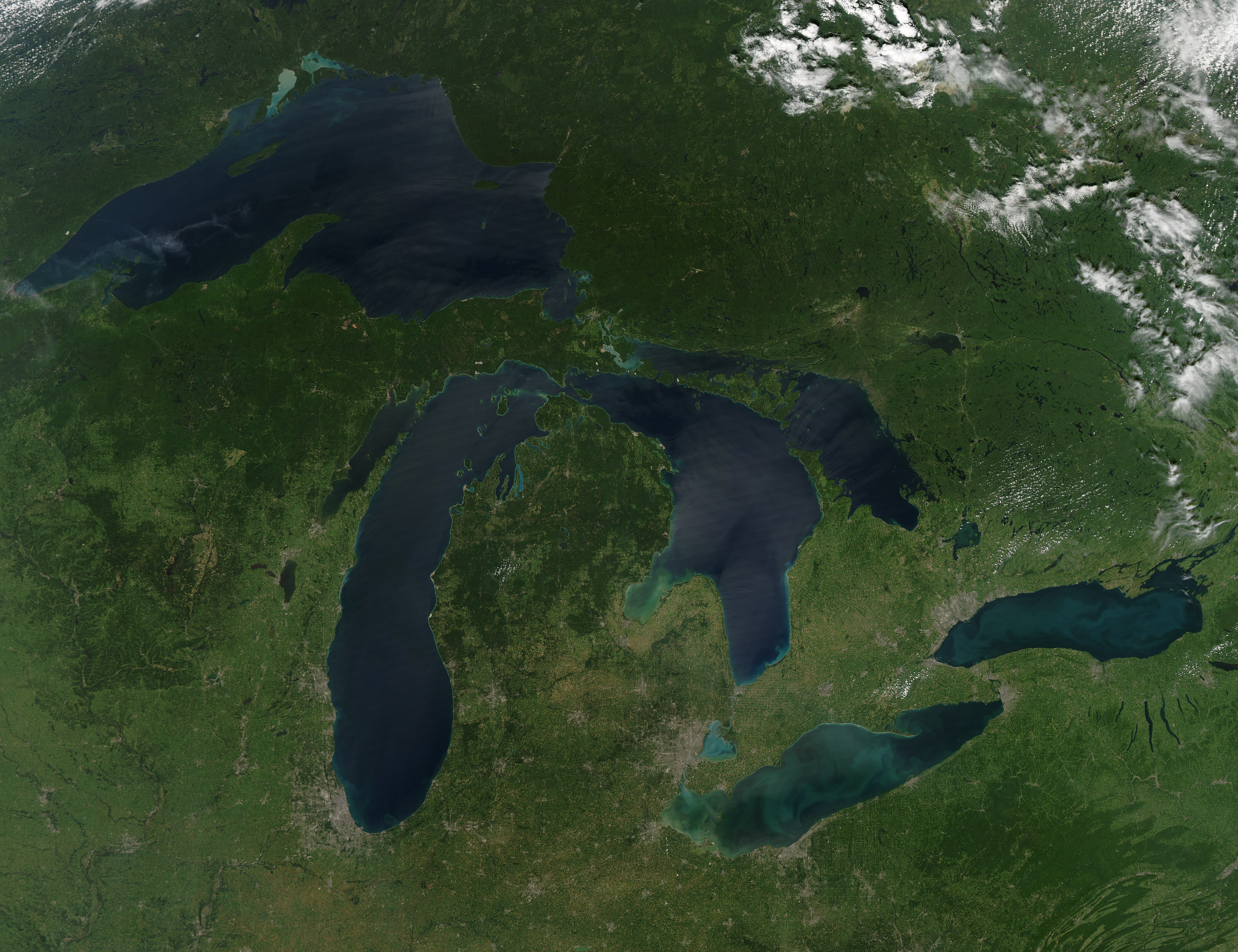
| Description | An image of the Great Lakes region of North America gathered by the Moderate Resolution Imaging Spectroradiometer (MODIS) on NASA’s Aqua satellite at 1:30 p.m. Central Daylight Time (18:30 UTC) on August 28, 2010. |
| Date | |
| Source | [ This image] from this page on the Earth Observatory website operated by the EOS Project Science Office located at NASA Goddard Space Flight Center |
| Author | NASA image by Jeff Schmaltz, MODIS Rapid Response Team, Goddard Space Flight |
| Permission (Reusing this file) |
PD-USGov-NASA |
| Other versions | File:Great-Lakes-no-clouds-2010-08-28.jpg (JPEG version) |
| This file is in the public domain in the United States because it was solely created by NASA. NASA copyright policy states that "NASA material is not protected by copyright unless noted". (See Template:PD-USGov, NASA copyright policy page or JPL Image Use Policy.) | ||
 |
Warnings:
|
File history
Click on a date/time to view the file as it appeared at that time.
| Date/Time | Thumbnail | Dimensions | User | Comment | |
|---|---|---|---|---|---|
| current | 05:24, 21 September 2010 | | 5,200 × 4,000 (26.11 MB) | Nihonjoe (talk | contribs) | {{Information |Description=An image of the Great Lakes region of North America gathered by the Moderate Resolution Imaging Spectroradiometer (MODIS) on NASA’s Aqua satellite at 1:30 p.m. Central Daylight Time (18:30 UTC) on August 28, 2010. |Source=[ Th |
You cannot overwrite this file.
File usage on Commons
The following 4 pages use this file:
File usage on other wikis
The following other wikis use this file:
- Usage on pl.wiktionary.org