File:AAE.png
Jump to navigation
Jump to search
Size of this preview: 618 × 600 pixels. Other resolutions: 247 × 240 pixels | 495 × 480 pixels | 735 × 713 pixels.
Original file (735 × 713 pixels, file size: 74 KB, MIME type: image/png)
Captions
Captions
Add a one-line explanation of what this file represents

|
This transport map image could be re-created using vector graphics as an SVG file. This has several advantages; see Commons:Media for cleanup for more information. If an SVG form of this image is available, please upload it and afterwards replace this template with
{{vector version available|new image name}}.
It is recommended to name the SVG file “AAE.svg”—then the template Vector version available (or Vva) does not need the new image name parameter. |
| Description |
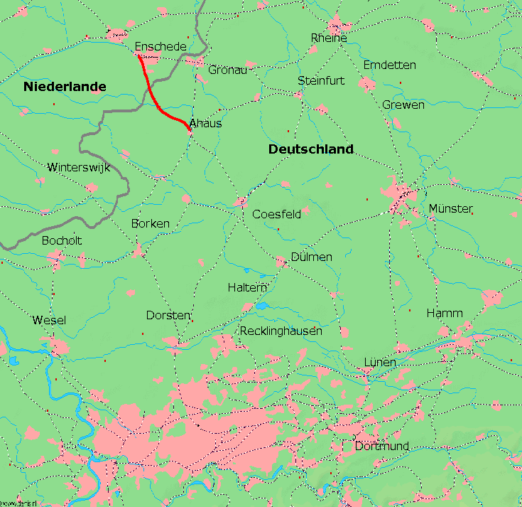
Deutsch: Karte der de:Ahaus-Enscheder Eisenbahn AG |
||||
| Source | http://www.demis.nl/mapserver/mapper.asp | ||||
| Author |
|
||||
| Permission (Reusing this file) |
|
File history
Click on a date/time to view the file as it appeared at that time.
| Date/Time | Thumbnail | Dimensions | User | Comment | |
|---|---|---|---|---|---|
| current | 14:33, 15 October 2011 | | 735 × 713 (74 KB) | Quedel (talk | contribs) | {{Information |Description ={{de|1=Karte der de:Ahaus-Enscheder Eisenbahn AG}} |Source =http://www.demis.nl/mapserver/mapper.asp |Author =Demis.nl |Date = |Permission ={{PD-Demis}} |other_versions = }} |
You cannot overwrite this file.
File usage on Commons
The following page uses this file:
File usage on other wikis
The following other wikis use this file:
- Usage on de.wikipedia.org
- Usage on www.wikidata.org